File:Dera2001.jpg
Jump to navigation
Jump to search

Size of this preview: 548 × 600 pixels. Other resolutions: 219 × 240 pixels | 438 × 480 pixels | 702 × 768 pixels | 935 × 1,024 pixels | 1,395 × 1,527 pixels.
Original file (1,395 × 1,527 pixels, file size: 1.04 MB, MIME type: image/jpeg)
Summary
| Description |
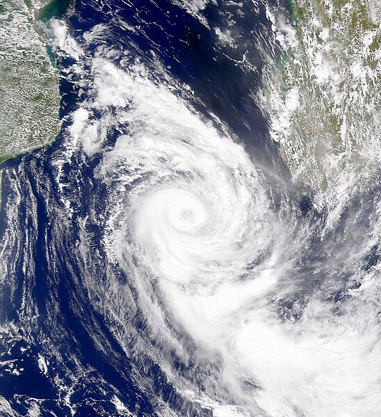
English: Cyclone Dera has moved to the southern end of the Mozambique Channel in this SeaWiFS image. |
| Date | |
| Source | http://visibleearth.nasa.gov/view_rec.php?id=1702 |
| Author | Provided by the SeaWiFS Project, NASA/Goddard Space Flight Center, and ORBIMAGE |
Licensing
| This image is from the Sea-viewing Wide Field-of-view Sensor (SeaWiFS) Project and more than 5 years old.
Satellite data captured by the SeaWIFS sensor are released into the public domain 5 years after capture. Data less than five years old can be re-used only for educational or scientific purposes; any commercial use of such images must be coordinated with GeoEye. [1] |
| This work has been released into the public domain by its copyright holder, GeoEye. This applies worldwide. In some countries this may not be legally possible; if so: GeoEye grants anyone the right to use this work for any purpose, without any conditions, unless such conditions are required by law.
|
File history
Click on a date/time to view the file as it appeared at that time.
| Date/Time | Thumbnail | Dimensions | User | Comment | |
|---|---|---|---|---|---|
| current | 19:43, 4 January 2020 | | 1,395 × 1,527 (1.04 MB) | commons>Sandy14156 | Cropped and centered |
File usage
There are no pages that use this file.