File:Davis Creek WV map.png
Jump to navigation
Jump to search

Size of this preview: 785 × 600 pixels. Other resolutions: 314 × 240 pixels | 628 × 480 pixels | 1,005 × 768 pixels | 1,280 × 978 pixels | 2,560 × 1,957 pixels | 3,169 × 2,422 pixels.
Original file (3,169 × 2,422 pixels, file size: 6.86 MB, MIME type: image/png)
File history
Click on a date/time to view the file as it appeared at that time.
| Date/Time | Thumbnail | Dimensions | User | Comment | |
|---|---|---|---|---|---|
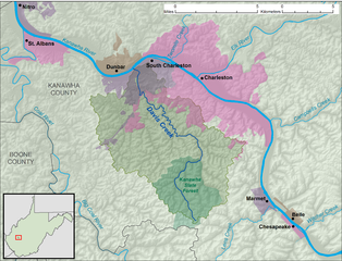
| current | 19:23, 24 November 2013 | | 3,169 × 2,422 (6.86 MB) | commons>TimK MSI | {{Information |Description ={{en|1=A map of Davis Creek and its watershed (USGS HUC-12 code 050500080302), in Kanawha County, West Virginia.}} |Source =Own work, data fr... |
File usage
There are no pages that use this file.