File:Darnestown - Hunting Hill 1878.png

From WikiProjectMed
Jump to navigation Jump to search

Original file(844 × 759 pixels, file size: 1.12 MB, MIME type: image/png)

This file is from a shared repository and may be used by other projects. The description on its file description page there is shown below.

Summary

Description
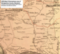
English: This 1878 map shows the Darnestown-Hunting Hill and areas south in Maryland. The northeast portion, inside the red dashed line, is part of today's North Potomac, CDP.
Date
Source This is a portion of a map created in 1879 by G.M. Hopkins that has been modified by TwoScarsUp. The entire map can be found in the Library of Congress map, and shows various sections of Montgomery County, Maryland, in 1878 plus additional places. This particular section is cropped from image 26.
Author G.M. Hopkins modified by TwoScarsUp

Licensing

Public domain
This work is in the public domain in the United States because it was published (or registered with the U.S. Copyright Office) before January 1, 1929.

Public domain works must be out of copyright in both the United States and in the source country of the work in order to be hosted on the Commons. If the work is not a U.S. work, the file must have an additional copyright tag indicating the copyright status in the source country.
Note: This tag should not be used for sound recordings.PD-1923Public domain in the United States//commons.wikimedia.org/wiki/File:Darnestown_-_Hunting_Hill_1878.png

Captions

1878 map showing Darnestown and Hunting Hill, Maryland.

Items portrayed in this file

depicts

image/png

dbfe50f6a97f6c302ba22157916d7491623e2c4b

1,171,728 byte

759 pixel

844 pixel

File history

Click on a date/time to view the file as it appeared at that time.

Date/TimeThumbnailDimensionsUserComment
current19:49, 14 May 2020Thumbnail for version as of 19:49, 14 May 2020844 × 759 (1.12 MB)commons>TwoScarsUpUploaded a work by G.M. Hopkins modified by TwoScarsUp from This is a portion of a map created in 1879 by G.M. Hopkins that has been modified by TwoScarsUp. The entire map can be found in the Library of Congress [https://www.loc.gov/resource/g3850m.gct00186/?r=-0.665,-0.061,2.331,1.46,0 map], and shows various sections of Montgomery County, Maryland, in 1878 plus additional places. This particular section is cropped from image 26. with UploadWizard

There are no pages that use this file.

Metadata