File:DEMVercors.png
Jump to navigation
Jump to search
Size of this preview: 545 × 600 pixels. Other resolutions: 218 × 240 pixels | 436 × 480 pixels | 698 × 768 pixels | 931 × 1,024 pixels | 1,958 × 2,154 pixels.
Original file (1,958 × 2,154 pixels, file size: 1.91 MB, MIME type: image/png)
File history
Click on a date/time to view the file as it appeared at that time.
| Date/Time | Thumbnail | Dimensions | User | Comment | |
|---|---|---|---|---|---|
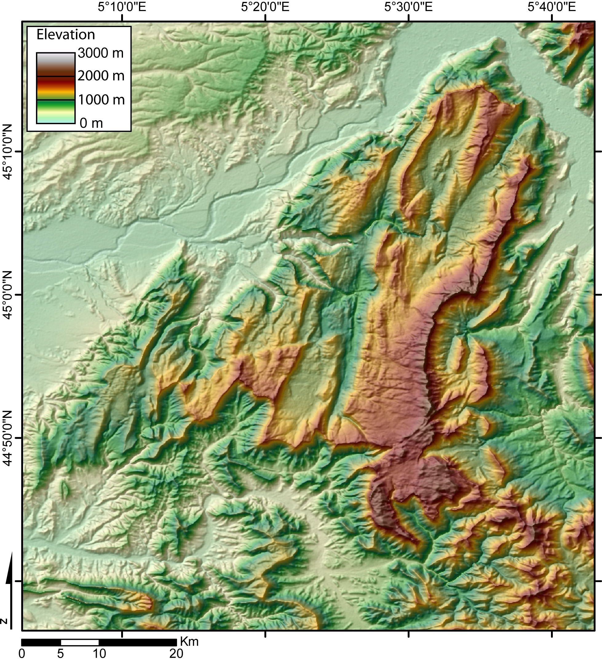
| current | 00:59, 8 November 2005 | | 1,958 × 2,154 (1.91 MB) | commons>Jide~commonswiki | Digital Elevation Model of the Vercors massif (French Alps) created by jide from the 90m pixel size SRTM dataset. The broad valley to the NW and NE is the Isere valley. The city of Grenoble lie in the Gresivaudan, at the NE of the Vercors massif. |
File usage
There are no pages that use this file.