File:DEMAoste.png
Jump to navigation
Jump to search
Size of this preview: 800 × 539 pixels. Other resolutions: 320 × 216 pixels | 640 × 432 pixels | 1,024 × 690 pixels | 1,280 × 863 pixels | 2,895 × 1,952 pixels.
Original file (2,895 × 1,952 pixels, file size: 4.78 MB, MIME type: image/png)
File history
Click on a date/time to view the file as it appeared at that time.
| Date/Time | Thumbnail | Dimensions | User | Comment | |
|---|---|---|---|---|---|
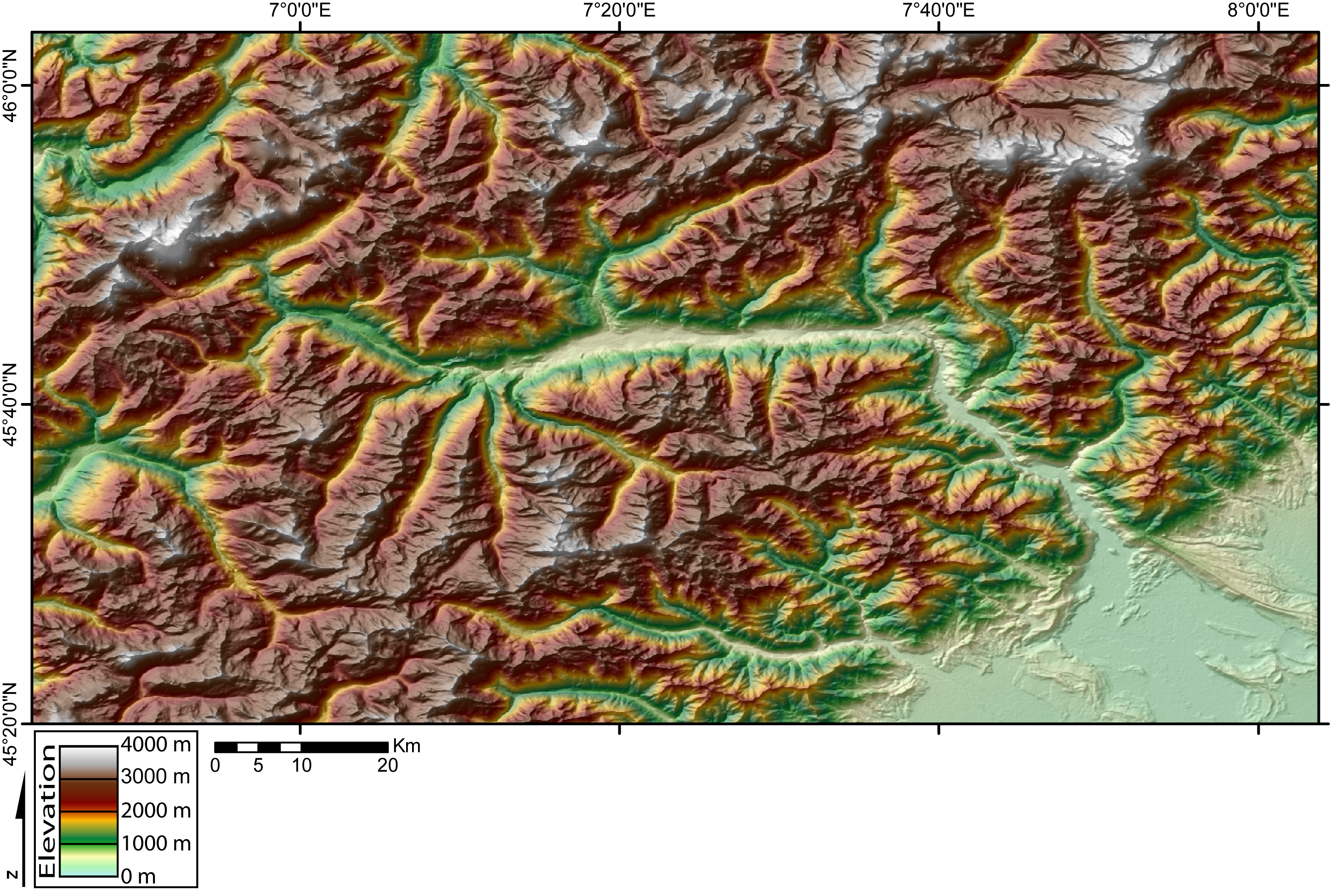
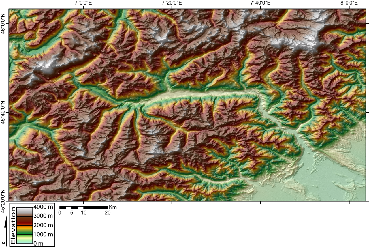
| current | 20:27, 11 November 2005 | | 2,895 × 1,952 (4.78 MB) | commons>Jide~commonswiki | DEM of the Val d'Aosta (W Italian Alps) created by Jide from the 90m pixel size SRTM dataset. The Dora Baltea river runs in the Aosta Valley from the West (Mont Blanc massif) to the East (Po plain). |
File usage
There are no pages that use this file.