File:Crete-Johnston-1861.png
Jump to navigation
Jump to search
Size of this preview: 800 × 397 pixels. Other resolutions: 320 × 159 pixels | 640 × 317 pixels | 1,024 × 508 pixels | 1,830 × 907 pixels.
Original file (1,830 × 907 pixels, file size: 2.93 MB, MIME type: image/png)
File history
Click on a date/time to view the file as it appeared at that time.
| Date/Time | Thumbnail | Dimensions | User | Comment | |
|---|---|---|---|---|---|
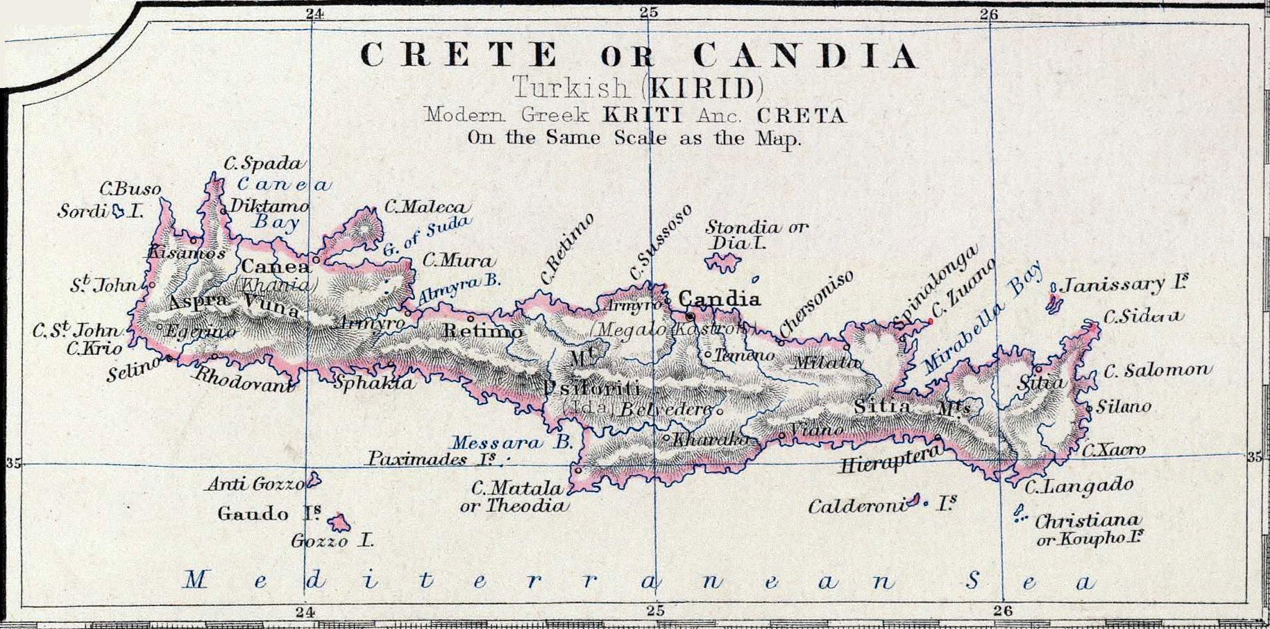
| current | 22:38, 16 November 2006 | | 1,830 × 907 (2.93 MB) | commons>Bejnar | {{Information |Description=Map ''Crete or Candia'' part of map ''Turkey in Europe'' |Source=Keith Johnston's General Atlas, p. 22, published by William Blackwood & Sons, Edinburgh & London |Date=1861 |Author=Johnston, Alexander Keith, 1804-1871 |Permiss |
File usage
There are no pages that use this file.