File:Craighead County Arkansas 2010 Township Map large.jpg
Jump to navigation
Jump to search
Size of this preview: 800 × 402 pixels. Other resolutions: 320 × 161 pixels | 640 × 322 pixels | 1,024 × 515 pixels | 2,000 × 1,006 pixels.
Original file (2,000 × 1,006 pixels, file size: 658 KB, MIME type: image/jpeg)
File history
Click on a date/time to view the file as it appeared at that time.
| Date/Time | Thumbnail | Dimensions | User | Comment | |
|---|---|---|---|---|---|
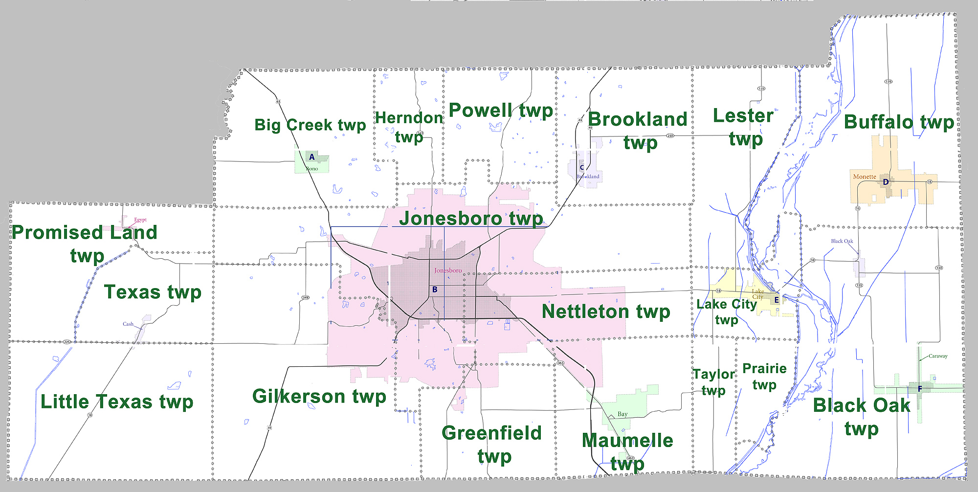
| current | 17:39, 30 August 2012 | | 2,000 × 1,006 (658 KB) | commons>MGA73bot2 | {{BotMoveToCommons|en.wikipedia|year={{subst:CURRENTYEAR}}|month={{subst:CURRENTMONTHNAME}}|day={{subst:CURRENTDAY}}}} {{Information |Description={{en|Large map showing townships in Craighead County, Arkansas. Modified from [http://www2.census.gov/ge... |
File usage
There are no pages that use this file.