File:Corn belt map.png
Jump to navigation
Jump to search

Size of this preview: 800 × 520 pixels. Other resolutions: 320 × 208 pixels | 640 × 416 pixels | 1,024 × 665 pixels | 1,513 × 983 pixels.
Original file (1,513 × 983 pixels, file size: 70 KB, MIME type: image/png)
File history
Click on a date/time to view the file as it appeared at that time.
| Date/Time | Thumbnail | Dimensions | User | Comment | |
|---|---|---|---|---|---|
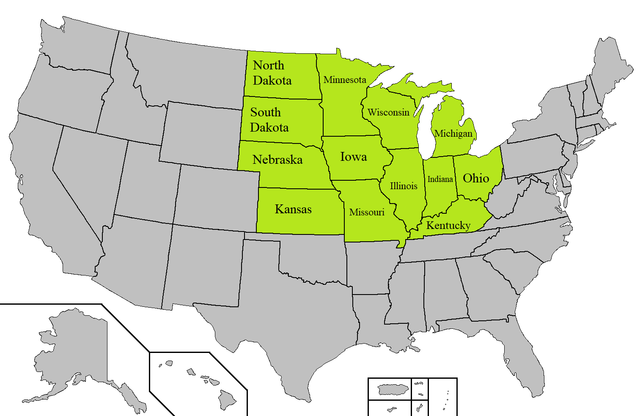
| current | 08:00, 3 October 2019 | | 1,513 × 983 (70 KB) | commons>Orangeladywallpaper | {{subst:Upload marker added by en.wp UW}} {{Information |Description = {{en|A map of the American Corn belt. Uses this map:https://commons.wikimedia.org/wiki/File:Blank_map_of_the_United_States.PNG}} |Source = https://commons.wikimedia.org/wiki/File:Blank_map_of_the_United_States.PNG |Date = unsure |Author = https://commons.wikimedia.org/wiki/File:Blank_map_of_the_United_States.PNG |Permission = https://commons.wikimedia.org/wiki/File:Blank_map_of_the_United_States.PNG }} GNU General Publi... |
File usage
There are no pages that use this file.