File:Colombia land 1970.jpg
Jump to navigation
Jump to search

Size of this preview: 463 × 599 pixels. Other resolutions: 185 × 240 pixels | 371 × 480 pixels | 744 × 963 pixels.
Original file (744 × 963 pixels, file size: 153 KB, MIME type: image/jpeg)
File history
Click on a date/time to view the file as it appeared at that time.
| Date/Time | Thumbnail | Dimensions | User | Comment | |
|---|---|---|---|---|---|
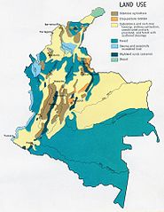
| current | 19:32, 27 October 2005 | | 744 × 963 (153 KB) | commons>Brian0918 | Land use map of Colombia. http://www.lib.utexas.edu/maps/colombia.html {{PD-USGov-CIA}} Category:Maps of Colombia |
File usage
There are no pages that use this file.