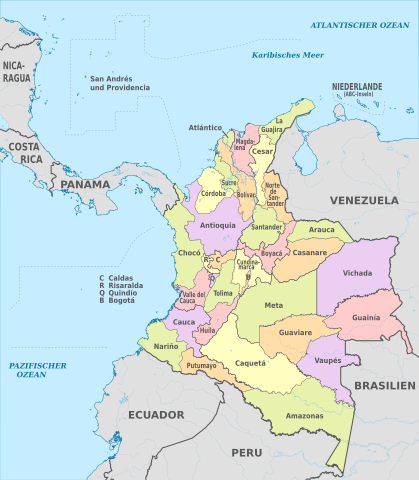
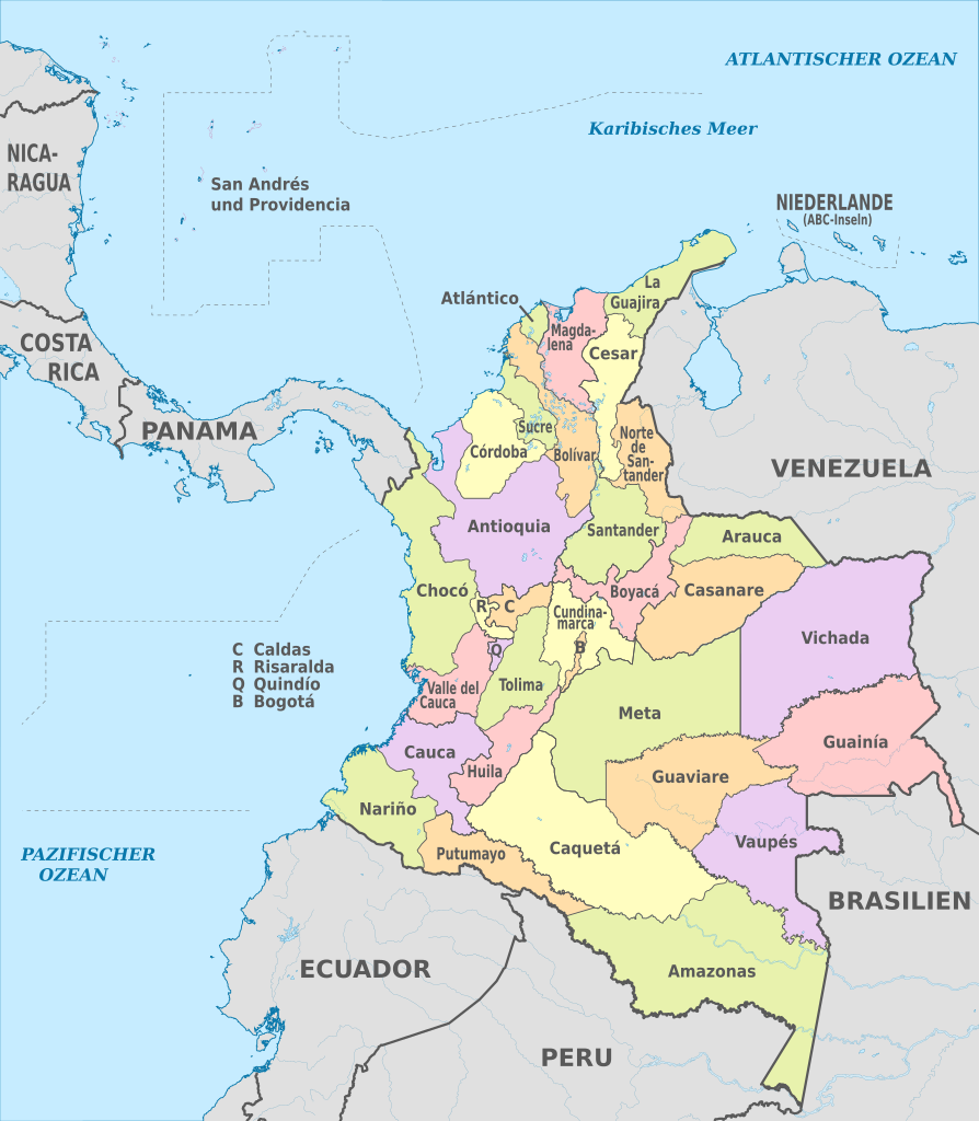
File:Colombia, administrative divisions - de - colored.svg
Jump to navigation
Jump to search

Size of this PNG preview of this SVG file: 524 × 600 pixels. Other resolutions: 210 × 240 pixels | 419 × 480 pixels | 671 × 768 pixels | 894 × 1,024 pixels | 1,789 × 2,048 pixels | 2,007 × 2,298 pixels.
Original file (SVG file, nominally 2,007 × 2,298 pixels, file size: 1.37 MB)
File history
Click on a date/time to view the file as it appeared at that time.
| Date/Time | Thumbnail | Dimensions | User | Comment | |
|---|---|---|---|---|---|
| current | 22:21, 16 October 2012 | | 2,007 × 2,298 (1.37 MB) | commons>TUBS | == {{int:filedesc}} == {{Information |Description={{de|Karte der politischen Gliederung von XY (siehe Dateiname)}} {{en|Map of administrative divisions of XY (see filename)}} |Source={{own}}{{Adobe Illustrator}}{{Commonist}}{{AttribSVG|Colombia_locati... |
File usage
There are no pages that use this file.