File:Clutha River Basin.jpg
Jump to navigation
Jump to search

Size of this preview: 762 × 599 pixels. Other resolutions: 305 × 240 pixels | 610 × 480 pixels | 977 × 768 pixels | 1,068 × 840 pixels.
Original file (1,068 × 840 pixels, file size: 185 KB, MIME type: image/jpeg)
Summary
| Description |
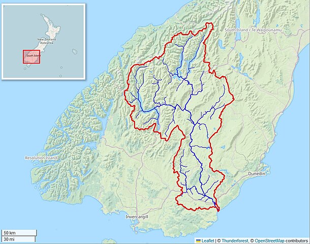
English: Map of the Clutha River Watershed on New Zealand's South Island. Created with the free Global Watersheds web app. Permalink to interactive map: https://mghydro.com/watersheds/shared/D4C8C5.html |
| Date | |
| Source | Own work |
| Author | Mheberger |
Licensing
I, the copyright holder of this work, hereby publish it under the following license:
This file is licensed under the Creative Commons Attribution-Share Alike 4.0 International license.
- You are free:
- to share – to copy, distribute and transmit the work
- to remix – to adapt the work
- Under the following conditions:
- attribution – You must give appropriate credit, provide a link to the license, and indicate if changes were made. You may do so in any reasonable manner, but not in any way that suggests the licensor endorses you or your use.
- share alike – If you remix, transform, or build upon the material, you must distribute your contributions under the same or compatible license as the original.
File history
Click on a date/time to view the file as it appeared at that time.
| Date/Time | Thumbnail | Dimensions | User | Comment | |
|---|---|---|---|---|---|
| current | 14:24, 24 February 2024 | | 1,068 × 840 (185 KB) | commons>Mheberger | Uploaded while editing "Clutha River" on en.wikipedia.org |
File usage
There are no pages that use this file.