File:Clerkenwell 1805 Cartographer; Tyrer, James.jpg
Jump to navigation
Jump to search

Size of this preview: 563 × 599 pixels. Other resolutions: 225 × 240 pixels | 451 × 480 pixels | 712 × 758 pixels.
Original file (712 × 758 pixels, file size: 253 KB, MIME type: image/jpeg)
File history
Click on a date/time to view the file as it appeared at that time.
| Date/Time | Thumbnail | Dimensions | User | Comment | |
|---|---|---|---|---|---|
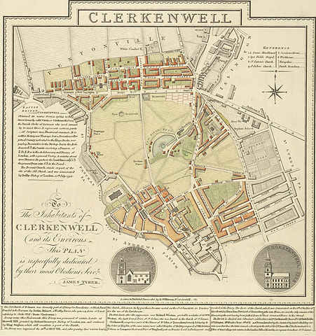
| current | 00:14, 16 February 2006 | | 712 × 758 (253 KB) | commons>Merchbow~commonswiki | A plan of Clerkenwell in London by James Tyrer, 1805. The old part of Clerkenwell, which lies immediately to the north of the City of London, is at the bottom of the map. Development has occurred along much of Clerkenwell's north-axis of St John Street. T |
File usage
There are no pages that use this file.