File:Claimed and de facto territory of Rojava.png
Jump to navigation
Jump to search

Size of this preview: 725 × 599 pixels. Other resolutions: 290 × 240 pixels | 581 × 480 pixels | 929 × 768 pixels | 1,239 × 1,024 pixels | 2,000 × 1,653 pixels.
Original file (2,000 × 1,653 pixels, file size: 277 KB, MIME type: image/png)
Summary
| Description |
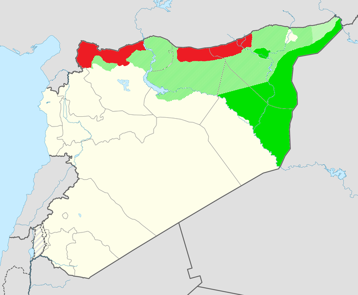
English: Claimed territory of Rojava (in orange) not currently under control and the de facto territory controlled by the Syrian Democratic Forces (in green). |
| Date | |
| Source | Own work |
| Author | Editor abcdef |
| Permission (Reusing this file) |
This image includes elements that have been taken or adapted from this file: |
Licensing
This file is licensed under the Creative Commons Attribution-Share Alike 3.0 Unported license.
- You are free:
- to share – to copy, distribute and transmit the work
- to remix – to adapt the work
- Under the following conditions:
- attribution – You must give appropriate credit, provide a link to the license, and indicate if changes were made. You may do so in any reasonable manner, but not in any way that suggests the licensor endorses you or your use.
- share alike – If you remix, transform, or build upon the material, you must distribute your contributions under the same or compatible license as the original.
File history
Click on a date/time to view the file as it appeared at that time.
| Date/Time | Thumbnail | Dimensions | User | Comment | |
|---|---|---|---|---|---|
| current | 12:34, 2 April 2020 | | 2,000 × 1,653 (277 KB) | commons>Bill497 | Update per http://syria.mil.ru/peacemaking/infographics.htm |
File usage
There are no pages that use this file.