File:Civitas Londinium or The Agas Map of London.jpg
Jump to navigation
Jump to search

Size of this preview: 800 × 338 pixels. Other resolutions: 320 × 135 pixels | 640 × 271 pixels | 1,024 × 433 pixels | 1,280 × 541 pixels | 4,730 × 2,000 pixels.
Original file (4,730 × 2,000 pixels, file size: 4.08 MB, MIME type: image/jpeg)
File history
Click on a date/time to view the file as it appeared at that time.
| Date/Time | Thumbnail | Dimensions | User | Comment | |
|---|---|---|---|---|---|
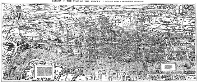
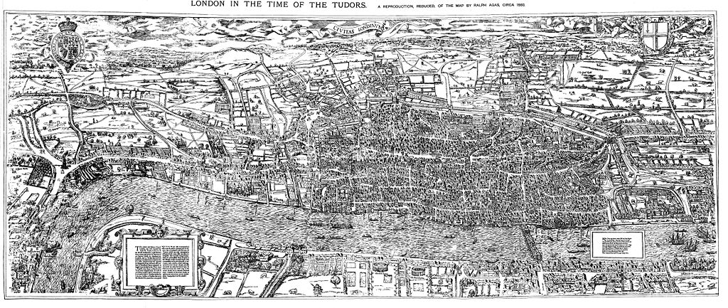
| current | 18:59, 14 August 2009 | | 4,730 × 2,000 (4.08 MB) | commons>MikeCalder | {{Information |Description={{en|1=The earliest proper map (as opposed to panorama) of London known. Attributed to Ralph Agas, and probably surveyed between 1570 and 1605. The original was 6 foot 0.5 inches long by 2 feet 4.5 inches wide. This much reduc |
File usage
There are no pages that use this file.