File:City Lights 2012 - Flat map crop.jpg
Jump to navigation
Jump to search

Size of this preview: 800 × 428 pixels. Other resolutions: 320 × 171 pixels | 640 × 342 pixels | 1,024 × 548 pixels | 1,280 × 685 pixels | 2,560 × 1,369 pixels | 11,358 × 6,075 pixels.
Original file (11,358 × 6,075 pixels, file size: 5.11 MB, MIME type: image/jpeg)
File history
Click on a date/time to view the file as it appeared at that time.
| Date/Time | Thumbnail | Dimensions | User | Comment | |
|---|---|---|---|---|---|
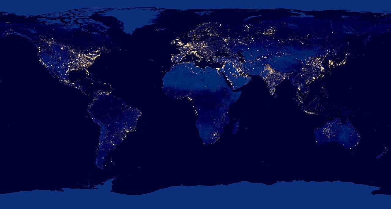
| current | 23:51, 20 March 2019 | | 11,358 × 6,075 (5.11 MB) | commons>Materialscientist | {{LargeImage}} =={{int:filedesc}}== {{Information |description={{en|1=Composite view of Earth at night from the Suomi NPP satellite in polar orbit 512 miles above the surface, from April 18, over nine days and for 13 days ending October 23, 2012.}} |date=2012-12-06 |source=http://www.nasa.gov/mission_pages/NPP/news/earth-at-night.html |author=NASA Earth Observatory |permission= |other_versions=File:City Lights 2012 - Flat map.jpg |other_fields= }} =={{int:license-header}}== {{PD-USGov-... |
File usage
There are no pages that use this file.