File:Churchill river hudson basin map.png
Jump to navigation
Jump to search
Size of this preview: 800 × 525 pixels. Other resolutions: 320 × 210 pixels | 640 × 420 pixels | 1,024 × 672 pixels | 1,200 × 788 pixels.
Original file (1,200 × 788 pixels, file size: 1.6 MB, MIME type: image/png)
File history
Click on a date/time to view the file as it appeared at that time.
| Date/Time | Thumbnail | Dimensions | User | Comment | |
|---|---|---|---|---|---|
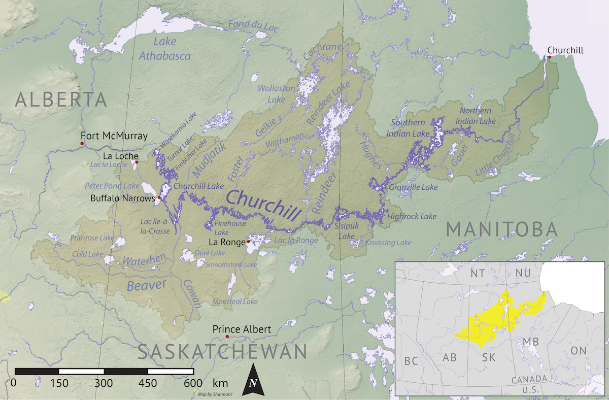
| current | 04:16, 7 November 2019 | | 1,200 × 788 (1.6 MB) | commons>Shannon1 | {{Information |description ={{en|1=Map of the Churchill River (Hudson Bay) drainage basin. Data derived from NASA SRTM, Natural Resources Canada, US Geological Survey, Natural Earth, all public domain.}} |date =2019-11-03 |source =Own work |author =Shannon1 }} Category:Churchill River |
File usage
There are no pages that use this file.