File:Chillagoe Railway and Mining Co. railway map.jpg
Jump to navigation
Jump to search
Size of this preview: 446 × 599 pixels. Other resolutions: 179 × 240 pixels | 357 × 480 pixels | 572 × 768 pixels | 763 × 1,024 pixels | 1,525 × 2,048 pixels | 3,681 × 4,942 pixels.
Original file (3,681 × 4,942 pixels, file size: 2.64 MB, MIME type: image/jpeg)
File history
Click on a date/time to view the file as it appeared at that time.
| Date/Time | Thumbnail | Dimensions | User | Comment | |
|---|---|---|---|---|---|
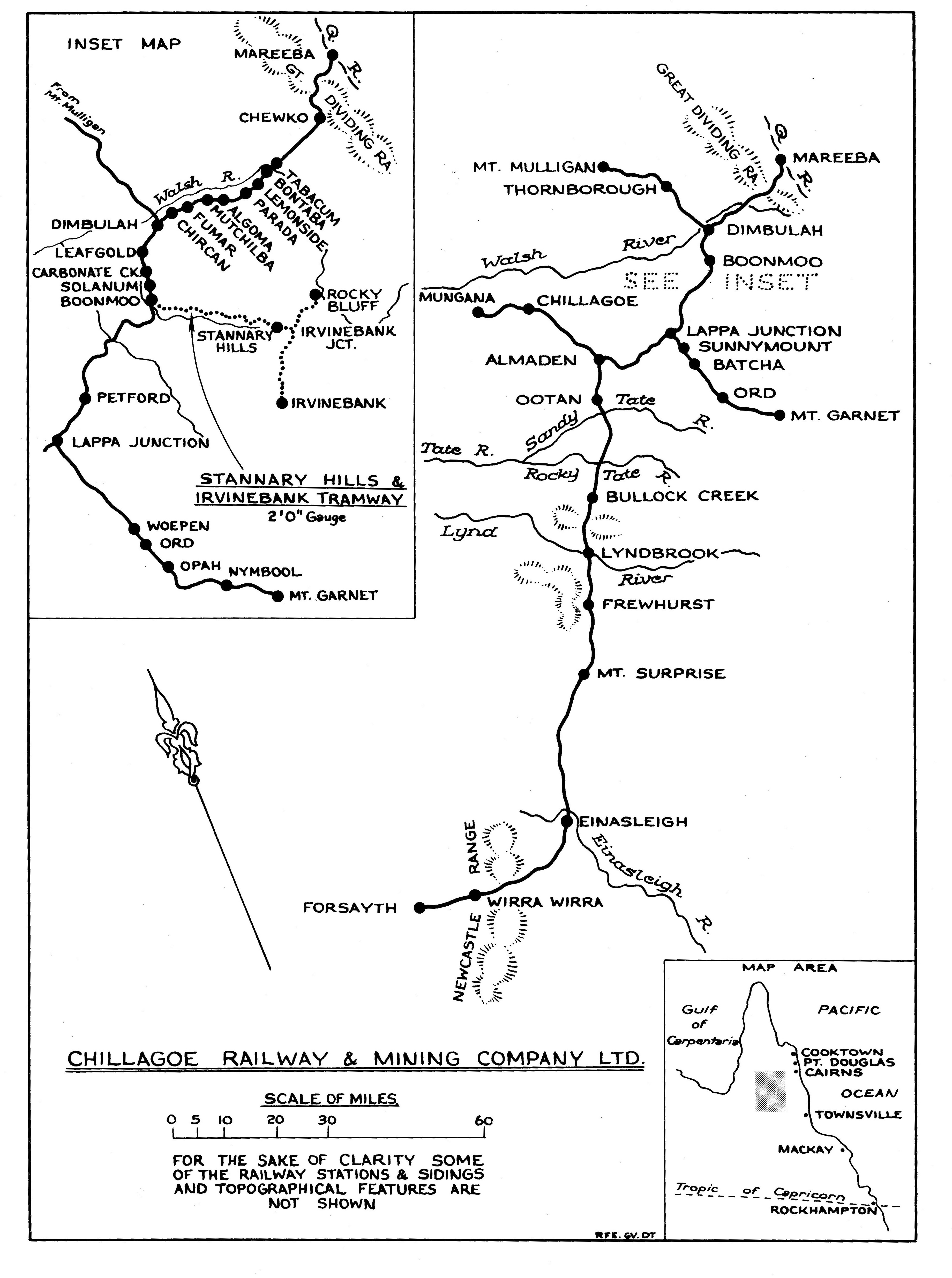
| current | 12:42, 3 October 2013 | | 3,681 × 4,942 (2.64 MB) | commons>Terry Toon | {{subst:Upload marker added by en.wp UW}} {{Information |Description = {{en|Chillagoe Railway and Mining Co. railway map from 1898 to 1960. Showing from Mareeba where the Queensland Government Railways finished and the then private railway of Chillagoe... |
File usage
There are no pages that use this file.