File:Chicxulub radar topography.jpg
Jump to navigation
Jump to search
Size of this preview: 536 × 599 pixels. Other resolutions: 215 × 240 pixels | 429 × 480 pixels | 715 × 799 pixels.
Original file (715 × 799 pixels, file size: 119 KB, MIME type: image/jpeg)
File history
Click on a date/time to view the file as it appeared at that time.
| Date/Time | Thumbnail | Dimensions | User | Comment | |
|---|---|---|---|---|---|
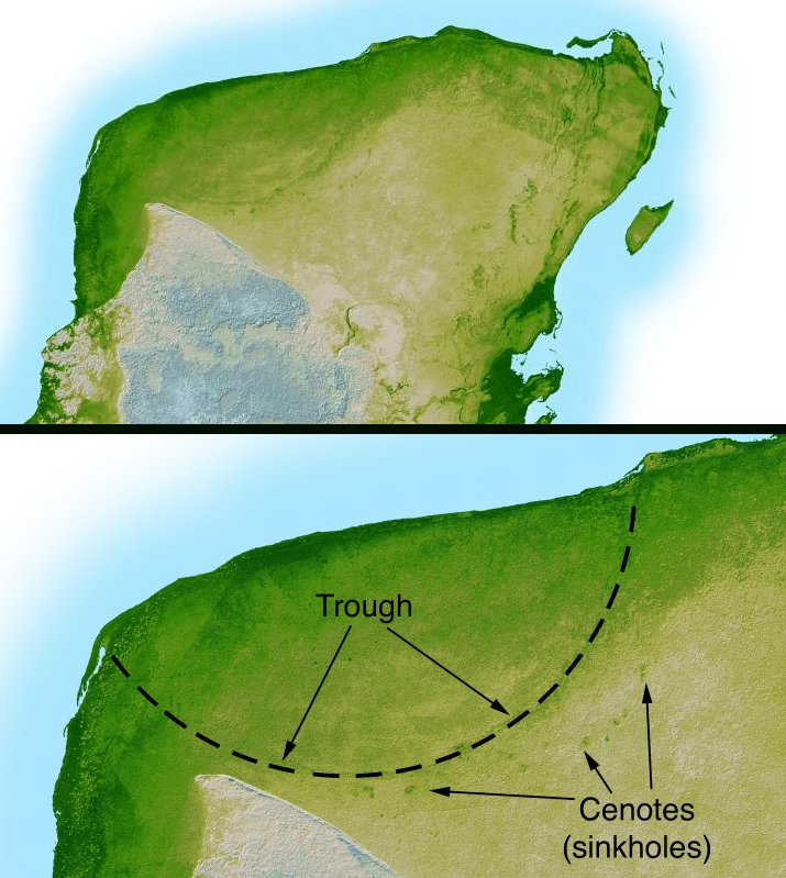
| current | 04:38, 11 September 2005 | | 715 × 799 (119 KB) | commons>Miya | This image is originally uploaded to English Wikipedia with the informaion as follows: [[{{PD}}Radar topography]] (color corresponds to height) of the [[{{PD}}Yucatán]] peninsula, revealing the en:Chicxulub Crater. Courtesy NASA/JPL-Caltech (it is |
File usage
There are no pages that use this file.