File:Cefnllys Castle II.jpg
Original file (4,000 × 3,000 pixels, file size: 4.75 MB, MIME type: image/jpeg)
This file is from a shared repository and may be used by other projects. The description on its file description page there is shown below.
Summary
DescriptionCefnllys Castle II.jpg |
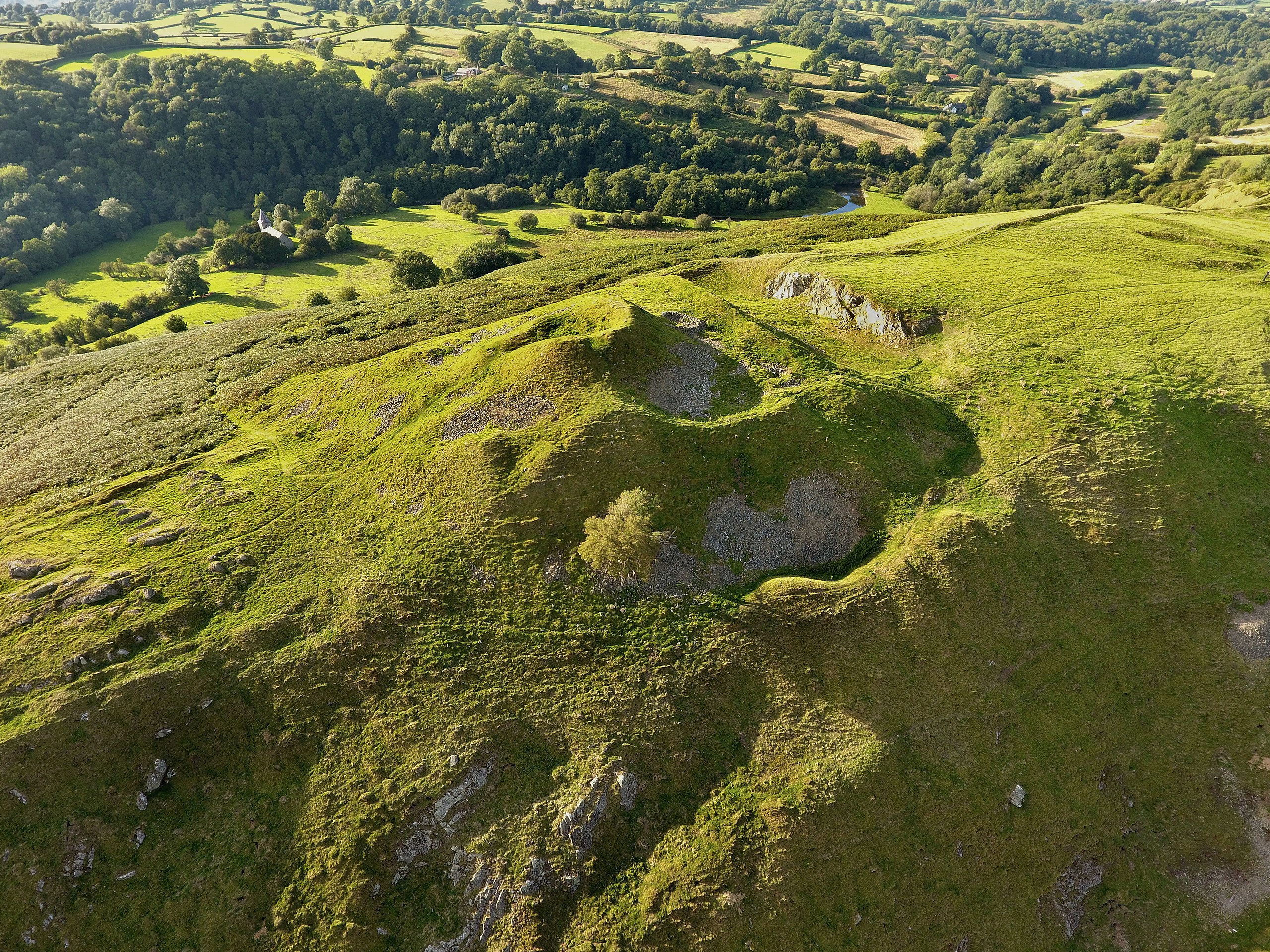
English: Aerial view of southern Castle (II) at Cefnllys. Drone photography by Julian Ravest. (CPAT ID: 4236-3418) |
||
Date | |||
Source | Clwyd-Powys Archaeological Trust, Historic Environment Record | ||
Author | Julian Ravest (Copyright holder: Clwyd-Powys Archaeological Trust) | ||
Permission (Reusing this file) |
|
Camera location | 52° 14′ 31.84″ N, 3° 20′ 09.01″ W | View this and other nearby images on: OpenStreetMap | 52.242177; -3.335836 |
---|
Licensing
- You are free:
- to share – to copy, distribute and transmit the work
- to remix – to adapt the work
- Under the following conditions:
- attribution – You must give appropriate credit, provide a link to the license, and indicate if changes were made. You may do so in any reasonable manner, but not in any way that suggests the licensor endorses you or your use.
- share alike – If you remix, transform, or build upon the material, you must distribute your contributions under the same or compatible license as the original.
Items portrayed in this file
depicts
52°14'31.837"N, 3°20'9.010"W
31 August 2017
0.007897 second
2.8
3.61 millimetre
100
image/jpeg
b08a45e01b751e3a500d74a9bc1431935aa397d5
4,980,306 byte
3,000 pixel
4,000 pixel
File history
Click on a date/time to view the file as it appeared at that time.
Date/Time | Thumbnail | Dimensions | User | Comment | |
---|---|---|---|---|---|
current | 20:32, 6 October 2020 | 4,000 × 3,000 (4.75 MB) | commons>Jr8825 | Colour corrections |
File usage
There are no pages that use this file.
Metadata
This file contains additional information, probably added from the digital camera or scanner used to create or digitize it.
If the file has been modified from its original state, some details may not fully reflect the modified file.
Image title | DCIM\102MEDIA\DJI_0849.JPG |
---|---|
Camera manufacturer | DJI |
Camera model | FC330 |
Exposure time | 7,897/1,000,000 sec (0.007897) |
F Number | f/2.8 |
ISO speed rating | 100 |
Date and time of data generation | 17:41, 31 August 2017 |
Lens focal length | 3.61 mm |
User comments | DCIM\102MEDIA\DJI_0849.JPG |
Latitude | 52° 14′ 31.84″ N |
Longitude | 3° 20′ 9.01″ W |
Altitude | 299.349 meters above sea level |
JPEG file comment | DCIM\102MEDIA\DJI_0849.JPG |
Orientation | Normal |
Horizontal resolution | 72 dpi |
Vertical resolution | 72 dpi |
Software used | GIMP 2.10.20 |
File change date and time | 20:31, 6 October 2020 |
Y and C positioning | Centered |
Exposure Program | Normal program |
Exif version | 2.3 |
Date and time of digitizing | 17:41, 31 August 2017 |
Meaning of each component |
|
Image compression mode | 3.0783373333333 |
APEX aperture | 2.97 |
APEX exposure bias | 0.34375 |
Maximum land aperture | 2.97 APEX (f/2.8) |
Subject distance | 0 meters |
Metering mode | Center weighted average |
Light source | Unknown |
Flash | Flash did not fire, No flash function |
Supported Flashpix version | 0.1 |
Color space | sRGB |
File source | Digital still camera |
Scene type | 0 |
Custom image processing | Normal process |
Exposure mode | Auto exposure |
White balance | Manual white balance |
Focal length in 35 mm film | 20 mm |
Scene capture type | Standard |
Scene control | None |
Contrast | Hard |
Saturation | Normal |
Sharpness | Hard |
Subject distance range | Unknown |
GPS tag version | 0.0.0.0 |
Unique ID of original document | xmp.did:5e7a9213-50a3-423b-b33e-58c9ff56b93f |