File:Carte allobrogie.PNG
Jump to navigation
Jump to search

Size of this preview: 519 × 599 pixels. Other resolutions: 208 × 240 pixels | 416 × 480 pixels | 953 × 1,100 pixels.
Original file (953 × 1,100 pixels, file size: 283 KB, MIME type: image/png)
File history
Click on a date/time to view the file as it appeared at that time.
| Date/Time | Thumbnail | Dimensions | User | Comment | |
|---|---|---|---|---|---|
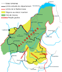
| current | 15:06, 19 November 2008 | | 953 × 1,100 (283 KB) | commons>Pedro38 | {{Information |Description={{fr|1=Carte des peuples gaulois en Isère réalisée par moi-même (Pedro38) avec Gimp sur le modèle de « La cité de Vienne : Un vaste territoire », Atlas du patrimoine de l’Isère, p41, édition : Glénat.}} |Source=trav |
File usage
There are no pages that use this file.