File:Carte Lewis-Clark Expedition-en.png
Jump to navigation
Jump to search

Size of this preview: 800 × 499 pixels. Other resolutions: 320 × 200 pixels | 640 × 400 pixels | 849 × 530 pixels.
Original file (849 × 530 pixels, file size: 193 KB, MIME type: image/png)
File history
Click on a date/time to view the file as it appeared at that time.
| Date/Time | Thumbnail | Dimensions | User | Comment | |
|---|---|---|---|---|---|
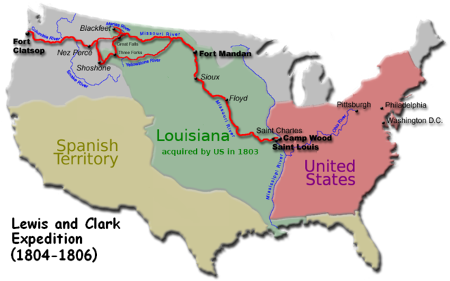
| current | 07:43, 7 December 2007 | | 849 × 530 (193 KB) | commons>EncMstr | {{Information |Description=Route of the w:Lewis and Clark Expedition |Source=EncMstr modified image:Carte Lewis-Clark Expedition.png to translate text to English. The French version was derived from http://de.wikipedia.org/wiki/Bild:Karte_Lewis |
File usage
There are no pages that use this file.