File:Carte-ORTF de.svg
Jump to navigation
Jump to search

Size of this PNG preview of this SVG file: 765 × 600 pixels. Other resolutions: 306 × 240 pixels | 612 × 480 pixels | 980 × 768 pixels | 1,280 × 1,004 pixels | 2,560 × 2,007 pixels | 875 × 686 pixels.
Original file (SVG file, nominally 875 × 686 pixels, file size: 211 KB)
File history
Click on a date/time to view the file as it appeared at that time.
| Date/Time | Thumbnail | Dimensions | User | Comment | |
|---|---|---|---|---|---|
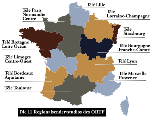
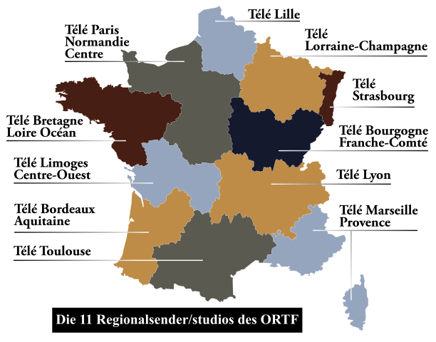
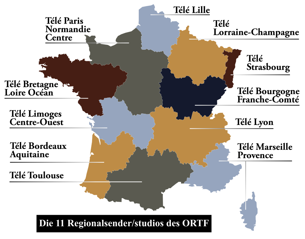
| current | 19:46, 5 May 2012 | | 875 × 686 (211 KB) | commons>Furfur | == {{int:filedesc}} == {{Information |Description={{de|1=Karte der regionalen Kanäle des ORTF}} {{fr|1=Carte des stations régionales de l'ORTF}} {{en|1=Map of regional channels of the ORTF}} |Source={{Derived from|Carte-ORTF.svg|display=50}} |Date=20... |
File usage
There are no pages that use this file.