File:Canudos-map.jpg
Jump to navigation
Jump to search
No higher resolution available.
Canudos-map.jpg (353 × 467 pixels, file size: 21 KB, MIME type: image/jpeg)
File history
Click on a date/time to view the file as it appeared at that time.
| Date/Time | Thumbnail | Dimensions | User | Comment | |
|---|---|---|---|---|---|
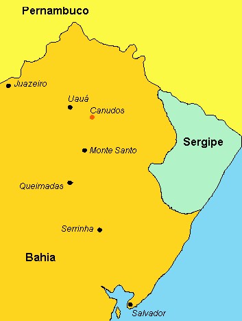
| current | 16:08, 4 September 2007 | | 353 × 467 (21 KB) | commons>Liftarn | {{SVG|map}} {{Information |Description=A political map of Northeast en:Brazil, showing the location of en:Canudos in the northern tip of the state of en:Bahia, an insurrected settlement under the leadership of mystic [[:en:Antonio Conselhe |
File usage
There are no pages that use this file.