File:Campbell Island New Zealand geographic map en.svg
Jump to navigation
Jump to search

Size of this PNG preview of this SVG file: 603 × 600 pixels. Other resolutions: 241 × 240 pixels | 482 × 480 pixels | 772 × 768 pixels | 1,029 × 1,024 pixels | 2,058 × 2,048 pixels | 1,005 × 1,000 pixels.
Original file (SVG file, nominally 1,005 × 1,000 pixels, file size: 755 KB)
File history
Click on a date/time to view the file as it appeared at that time.
| Date/Time | Thumbnail | Dimensions | User | Comment | |
|---|---|---|---|---|---|
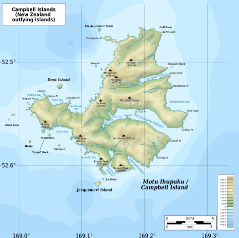
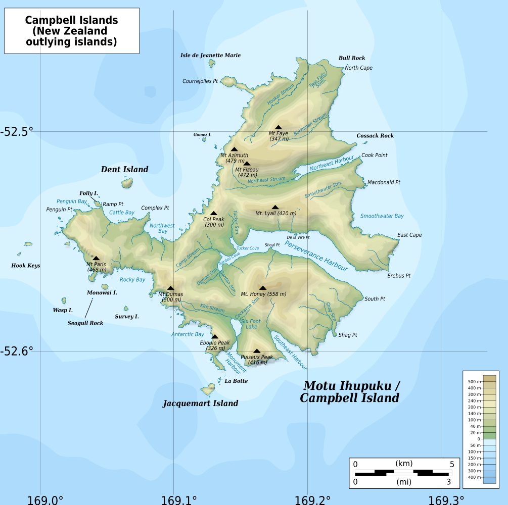
| current | 22:30, 12 February 2022 | | 1,005 × 1,000 (755 KB) | commons>Ikonact | == {{int:filedesc}} == {{Information |description={{en|1=Geographic map of {{W|Campbell Islands}}, {{W|New Zealand}} Geographic limits of the map: * N: 52.44° S * S: 52.67° S * W: 168.97° E * E: 169.35° E}} |date=2022-02-12 |source={{own}} *Bathymetry: ETOPO1 Public domain *Relief: [https://data.linz.govt.nz/layer/50927-nz-campbell-island-motu-ihupuku-contours-topo-150k/ NZ Campbell Island/Motu Ihupuku Contours: Land Information New Zealand] © Creative Commons Attribution 4.0 International *C... |
File usage
There are no pages that use this file.