File:C952 map of ash-Sham by Ibrahim ibn Muhammad Istakhri (rotated 180°).jpg
Jump to navigation
Jump to search
Size of this preview: 443 × 599 pixels. Other resolutions: 177 × 240 pixels | 355 × 480 pixels | 568 × 768 pixels | 757 × 1,024 pixels | 2,224 × 3,008 pixels.
Original file (2,224 × 3,008 pixels, file size: 3.23 MB, MIME type: image/jpeg)
.jpg)
File history
Click on a date/time to view the file as it appeared at that time.
| Date/Time | Thumbnail | Dimensions | User | Comment | |
|---|---|---|---|---|---|
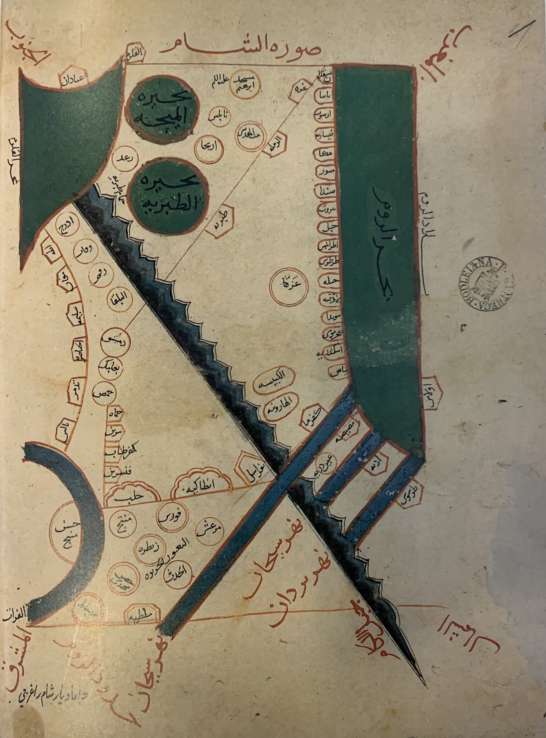
| current | 23:50, 25 February 2023 | | 2,224 × 3,008 (3.23 MB) | commons>Gryffindor | == {{int:filedesc}} == {{Information |Description={{en|"THE LAND OF ISRAEL IN IBRAHIM IBN MUHAMMAD ISTAKHRI'S MAP OF SYRIA (ca. 952). The 10th and 11th centuries were the era of the 'Atlas of Islam' - collections of maps which usually included representations of 17 Islamic countries. The sea to the left is ''Bahr al-Rum'' (Sea of the Greeks/Romans, which is the Mediterranean Sea)}} |Source=http://www.mfa.gov.il/MFA/History/Early+History+-+Archaeology/Jerusalem+in+Old+Maps+and+Views-... |
File usage
There are no pages that use this file.
.jpg)