File:C82037s5 Ant.Map Argentina Range.jpg
Jump to navigation
Jump to search
Size of this preview: 507 × 600 pixels. Other resolutions: 203 × 240 pixels | 406 × 480 pixels | 649 × 768 pixels | 866 × 1,024 pixels | 1,732 × 2,048 pixels | 2,791 × 3,301 pixels.
Original file (2,791 × 3,301 pixels, file size: 888 KB, MIME type: image/jpeg)
File history
Click on a date/time to view the file as it appeared at that time.
| Date/Time | Thumbnail | Dimensions | User | Comment | |
|---|---|---|---|---|---|
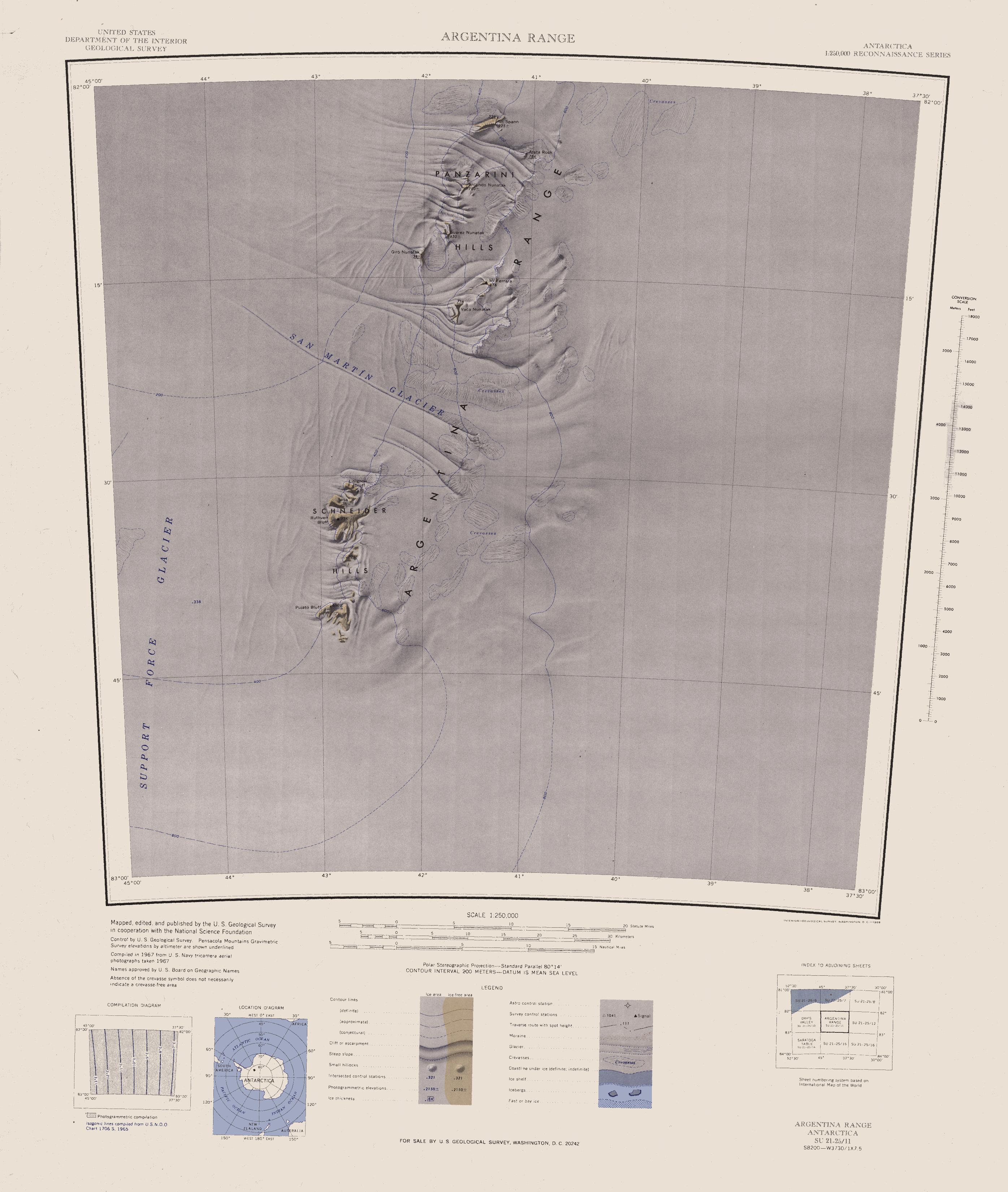
| current | 15:10, 3 April 2005 | | 2,791 × 3,301 (888 KB) | commons>Achim Raschka | Map of Antarctica by the United States Antarctic Ressource Center of the US Geological Society. {{PD-US}} Copyrights and Trademarks USGS-authored or produced data and information are in the public domain. While the content of most USGS web pages is in th |
File usage
There are no pages that use this file.