File:Butterfly Creek valley.jpg
Jump to navigation
Jump to search

Size of this preview: 800 × 600 pixels. Other resolutions: 320 × 240 pixels | 640 × 480 pixels | 1,024 × 768 pixels.
Original file (1,024 × 768 pixels, file size: 310 KB, MIME type: image/jpeg)
Summary
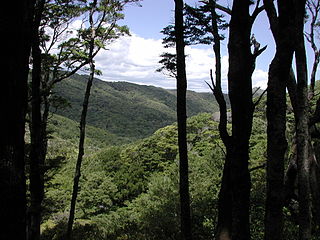
| Description | Native bush in Butterfly Creek valley in Orongorongo Range near Eastbourne, Wellington. |
| Date | |
| Source | Own work |
| Author | Pseudopanax at English Wikipedia |
| Camera location | | View this and other nearby images on: OpenStreetMap |
|---|
Licensing
| I, the copyright holder of this work, release this work into the public domain. This applies worldwide. In some countries this may not be legally possible; if so: I grant anyone the right to use this work for any purpose, without any conditions, unless such conditions are required by law. |
File history
Click on a date/time to view the file as it appeared at that time.
| Date/Time | Thumbnail | Dimensions | User | Comment | |
|---|---|---|---|---|---|
| current | 21:54, 1 July 2008 | | 1,024 × 768 (310 KB) | commons>Pseudopanax | == Summary == {{Information |Description=Native bush in Butterfly Creek valley in Orongorongo Range near Eastbourne, Wellington. |Source=self-made |Date=2007-12-23 |Author=Pseudopanax at [http://en.wikipedia.org en.wikipedia] }} { |
File usage
There are no pages that use this file.