File:Broughty Ferry Pier railway station (site), Dundee (geograph 4020085).jpg
Jump to navigation
Jump to search
Size of this preview: 800 × 600 pixels. Other resolutions: 320 × 240 pixels | 640 × 480 pixels | 1,024 × 768 pixels.
Original file (1,024 × 768 pixels, file size: 127 KB, MIME type: image/jpeg)
,_Dundee_(geograph_4020085).jpg)
Summary
| Description |
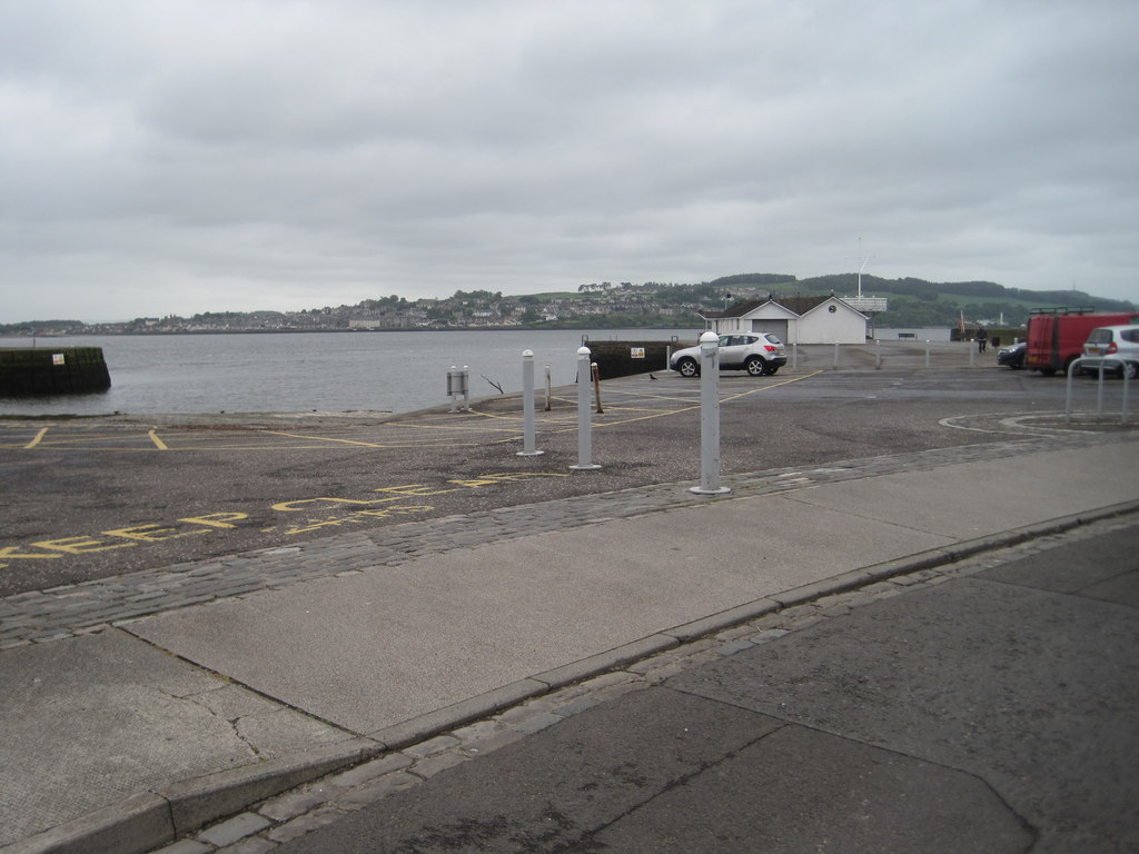
English: Broughty Ferry Pier railway station (site), Dundee Opened in 1848 by the Dundee & Arbroath Railway, later jointly owned by the North British and Caledonian Railway companies, this was where passengers from Arbroath would board the ferry to continue their journey south, in the days before the Tay Bridge. The station closed in 1887. View south towards the former buffers. The railway lines joined from the left-hand side and ran onto the pier. |
| Date | |
| Source | From geograph.org.uk |
| Author | Nigel Thompson |
| Permission (Reusing this file) |
Creative Commons Attribution Share-alike license 2.0 |
| Attribution (required by the license) | Nigel Thompson / Broughty Ferry Pier railway station (site), Dundee / |
| Camera location | | View this and other nearby images on: OpenStreetMap |
|---|
,_Dundee_(geograph_4020085).jpg¶ms=056.464299_N_-002.870977_E_globe:Earth_type:camera_source:geograph-osgb36(NO46433058)_heading:225.00&language=en)
| Object location | | View this and other nearby images on: OpenStreetMap |
|---|
,_Dundee_(geograph_4020085).jpg¶ms=056.463840_N_-002.871780_E_globe:Earth_class:object_type:object_source:geograph-osgb36(NO46383053)_heading:225.00&language=en)
Licensing

|
This image was taken from the Geograph project collection. See this photograph's page on the Geograph website for the photographer's contact details. The copyright on this image is owned by Nigel Thompson and is licensed for reuse under the Creative Commons Attribution-ShareAlike 2.0 license.
|
This file is licensed under the Creative Commons Attribution-Share Alike 2.0 Generic license.
Attribution: Nigel Thompson
- You are free:
- to share – to copy, distribute and transmit the work
- to remix – to adapt the work
- Under the following conditions:
- attribution – You must give appropriate credit, provide a link to the license, and indicate if changes were made. You may do so in any reasonable manner, but not in any way that suggests the licensor endorses you or your use.
- share alike – If you remix, transform, or build upon the material, you must distribute your contributions under the same or compatible license as the original.
File history
Click on a date/time to view the file as it appeared at that time.
| Date/Time | Thumbnail | Dimensions | User | Comment | |
|---|---|---|---|---|---|
| current | 22:41, 4 January 2020 | | 1,024 × 768 (127 KB) | commons>Lamberhurst | Transferred from geograph.co.uk using [https://tools.wmflabs.org/geograph2commons/ geograph2commons] |
File usage
There are no pages that use this file.
,_Dundee_(geograph_4020085).jpg)