File:Blank map of the North West (2016).svg
Jump to navigation
Jump to search

Size of this PNG preview of this SVG file: 800 × 569 pixels. Other resolutions: 320 × 228 pixels | 640 × 455 pixels | 1,024 × 728 pixels | 1,280 × 910 pixels | 2,560 × 1,821 pixels | 838 × 596 pixels.
Original file (SVG file, nominally 838 × 596 pixels, file size: 389 KB)
.svg)
File history
Click on a date/time to view the file as it appeared at that time.
| Date/Time | Thumbnail | Dimensions | User | Comment | |
|---|---|---|---|---|---|
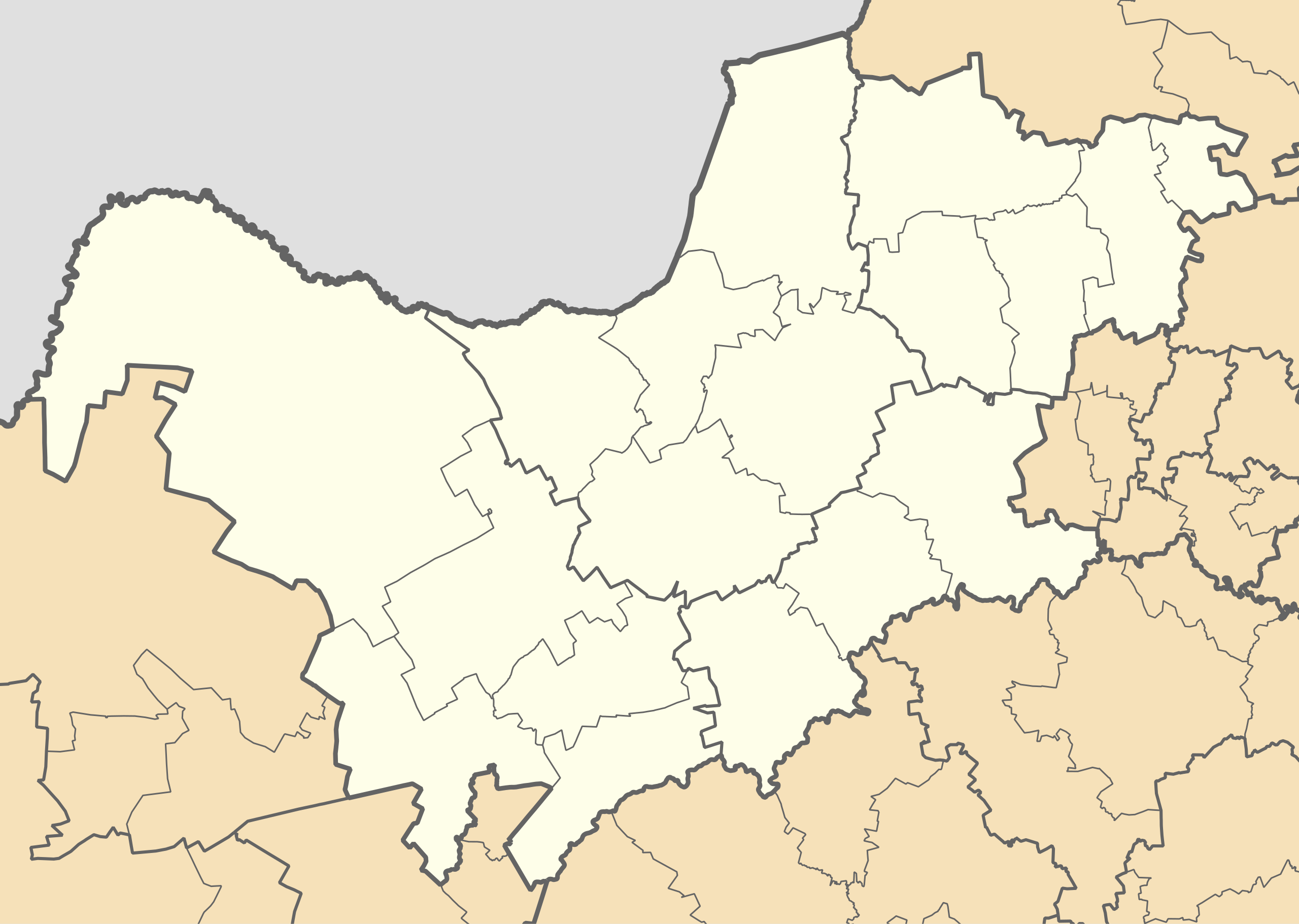
| current | 01:27, 18 August 2016 | | 838 × 596 (389 KB) | commons>Htonl | == {{int:filedesc}} == {{Information |Description ={{en|1=Blank map of the North West province of South Africa, with municipal boundaries as they are after the municipal elections of 3 August 2016. Equire... |
File usage
There are no pages that use this file.
.svg)