File:Blank map of Mpumalanga (2016).svg
Jump to navigation
Jump to search

Size of this PNG preview of this SVG file: 559 × 599 pixels. Other resolutions: 224 × 240 pixels | 448 × 480 pixels | 717 × 768 pixels | 955 × 1,024 pixels | 1,911 × 2,048 pixels | 683 × 732 pixels.
Original file (SVG file, nominally 683 × 732 pixels, file size: 345 KB)
.svg)
File history
Click on a date/time to view the file as it appeared at that time.
| Date/Time | Thumbnail | Dimensions | User | Comment | |
|---|---|---|---|---|---|
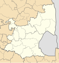
| current | 01:26, 18 August 2016 | | 683 × 732 (345 KB) | commons>Htonl | == {{int:filedesc}} == {{Information |Description ={{en|1=Blank map of Mpumalanga province of South Africa, with municipal boundaries as they are after the municipal elections of 3 August 2016. Equirectan... |
File usage
There are no pages that use this file.
.svg)