File:Black Hill (Peak District).jpg
Jump to navigation
Jump to search
Size of this preview: 800 × 600 pixels. Other resolutions: 320 × 240 pixels | 640 × 480 pixels | 1,024 × 768 pixels | 1,280 × 960 pixels | 2,048 × 1,536 pixels.
Original file (2,048 × 1,536 pixels, file size: 1.16 MB, MIME type: image/jpeg)
.jpg)
File history
Click on a date/time to view the file as it appeared at that time.
| Date/Time | Thumbnail | Dimensions | User | Comment | |
|---|---|---|---|---|---|
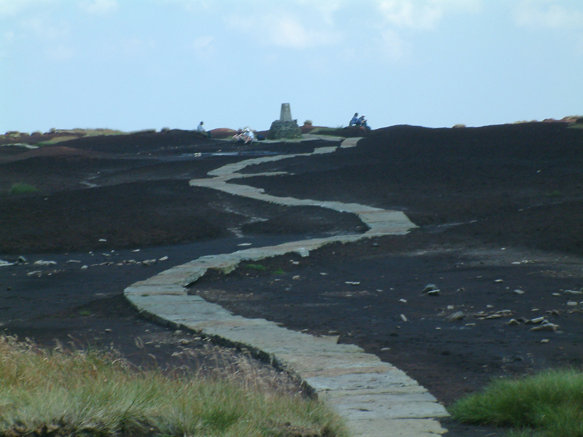
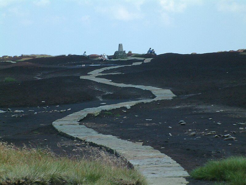
| current | 23:31, 1 September 2007 | | 2,048 × 1,536 (1.16 MB) | commons>Responsible? | {{Information |Description=The Pennine Way on the summit of Black Hill (Peak District). The triangulation column and highest point on Black Hill is on a small elevated mound, called Soldiers' Lump. According to Alfred Wainwright's ''Pennine Way Companion' |
File usage
There are no pages that use this file.
.jpg)