File:BlackSea1600 ru.svg
Jump to navigation
Jump to search

Size of this PNG preview of this SVG file: 800 × 567 pixels. Other resolutions: 320 × 227 pixels | 640 × 453 pixels | 1,024 × 725 pixels | 1,280 × 906 pixels | 2,560 × 1,813 pixels | 7,000 × 4,957 pixels.
Original file (SVG file, nominally 7,000 × 4,957 pixels, file size: 3.33 MB)
| Description |
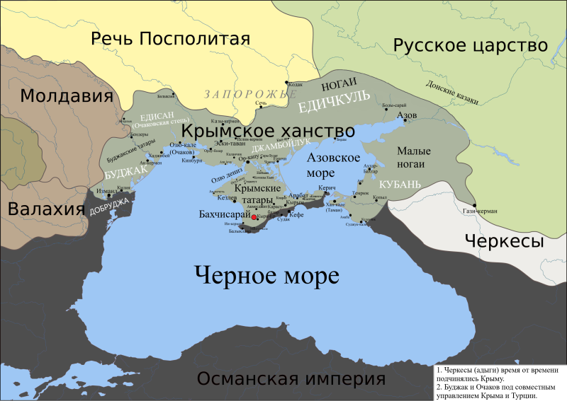
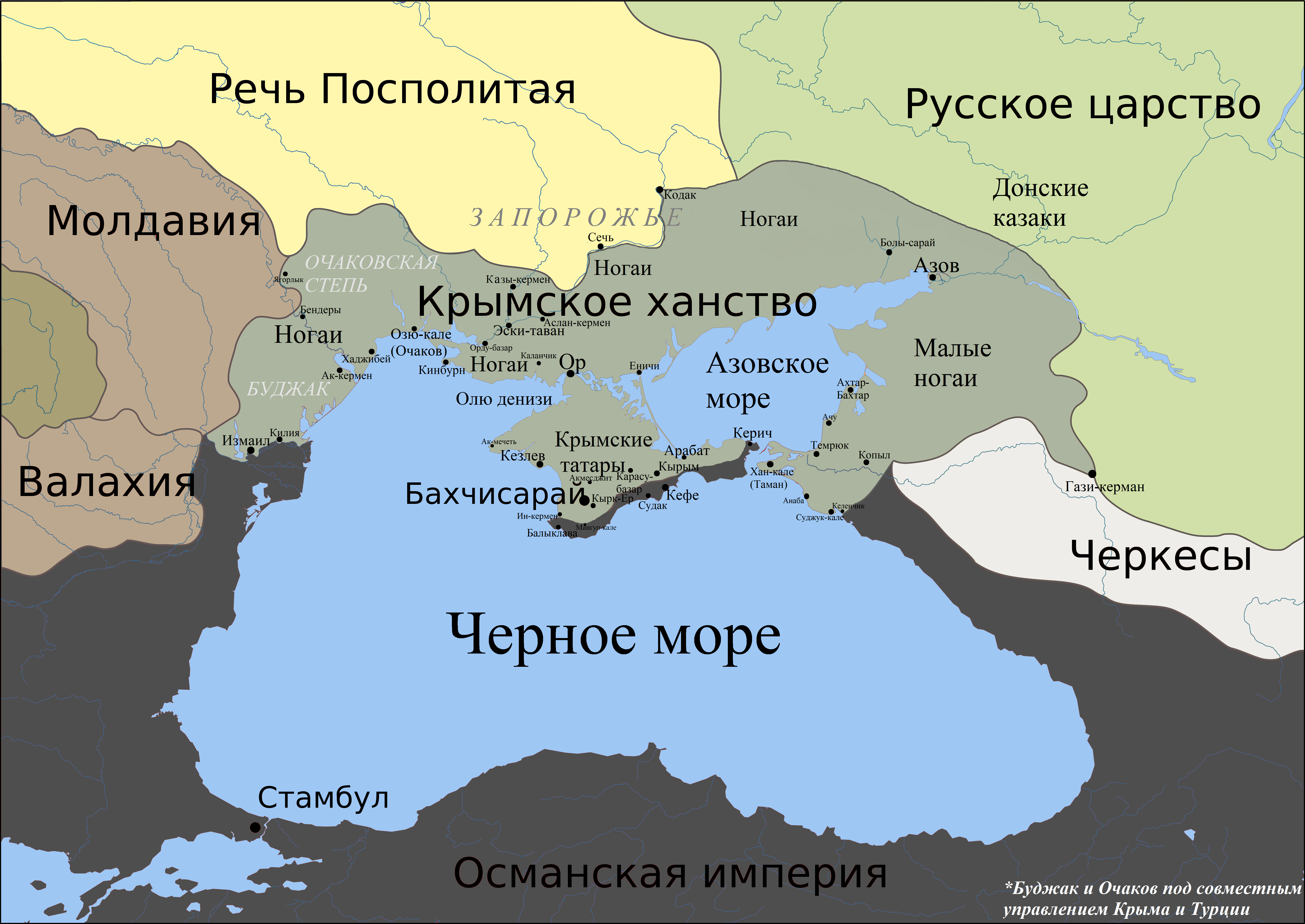
English: Political map of Black Sea region around 1600. |
| Date | (UTC) |
| Source |
used the map from Big Russian Encyclopedia 1600.gif, translated
|
| Author |
|
| Other versions | Derivative works of this file: BlackSea1600 uk.svg |

|
This SVG file contains embedded text that can be translated into your language, using any capable SVG editor, text editor or the SVG Translate tool. For more information see: About translating SVG files. |
| This is a retouched picture, which means that it has been digitally altered from its original version. The original can be viewed here: BlackSea.svg:
|
This file is licensed under the Creative Commons Attribution-Share Alike 3.0 Unported license.
- You are free:
- to share – to copy, distribute and transmit the work
- to remix – to adapt the work
- Under the following conditions:
- attribution – You must give appropriate credit, provide a link to the license, and indicate if changes were made. You may do so in any reasonable manner, but not in any way that suggests the licensor endorses you or your use.
- share alike – If you remix, transform, or build upon the material, you must distribute your contributions under the same or compatible license as the original.
Original upload log
This image is a derivative work of the following images:
- File:1600_rus.gif licensed with PD-self
- 2007-02-22T00:52:20Z Voevoda 450x371 (18989 Bytes) Author: Voevoda, Description: Political map of Black Sea region around 1600 Source: 1600.gif, translated
- File:BlackSea.svg licensed with Cc-by-3.0
- 2010-06-19T05:47:18Z Materialscientist 1771x1254 (3123100 Bytes) {{Information |Description={{ru|1=Создано при помощи [[:en:Generic Mapping Tools|Generic Mapping Tools]], [[:ru:Gimp|GIMP]] и [[:ru:Inkscape|Inkscape]]. Использованы данные [http://topex.ucs
Uploaded with derivativeFX
File history
Click on a date/time to view the file as it appeared at that time.
| Date/Time | Thumbnail | Dimensions | User | Comment | |
|---|---|---|---|---|---|
| current | 09:17, 6 June 2020 | | 7,000 × 4,957 (3.33 MB) | commons>Devlet Geray | better colours, more accurate |
File usage
There are no pages that use this file.