File:Bjerknes skikart 1890.jpg
Jump to navigation
Jump to search
Size of this preview: 478 × 600 pixels. Other resolutions: 191 × 240 pixels | 382 × 480 pixels | 612 × 768 pixels | 816 × 1,024 pixels | 2,155 × 2,704 pixels.
Original file (2,155 × 2,704 pixels, file size: 5.9 MB, MIME type: image/jpeg)
Summary
| Description |
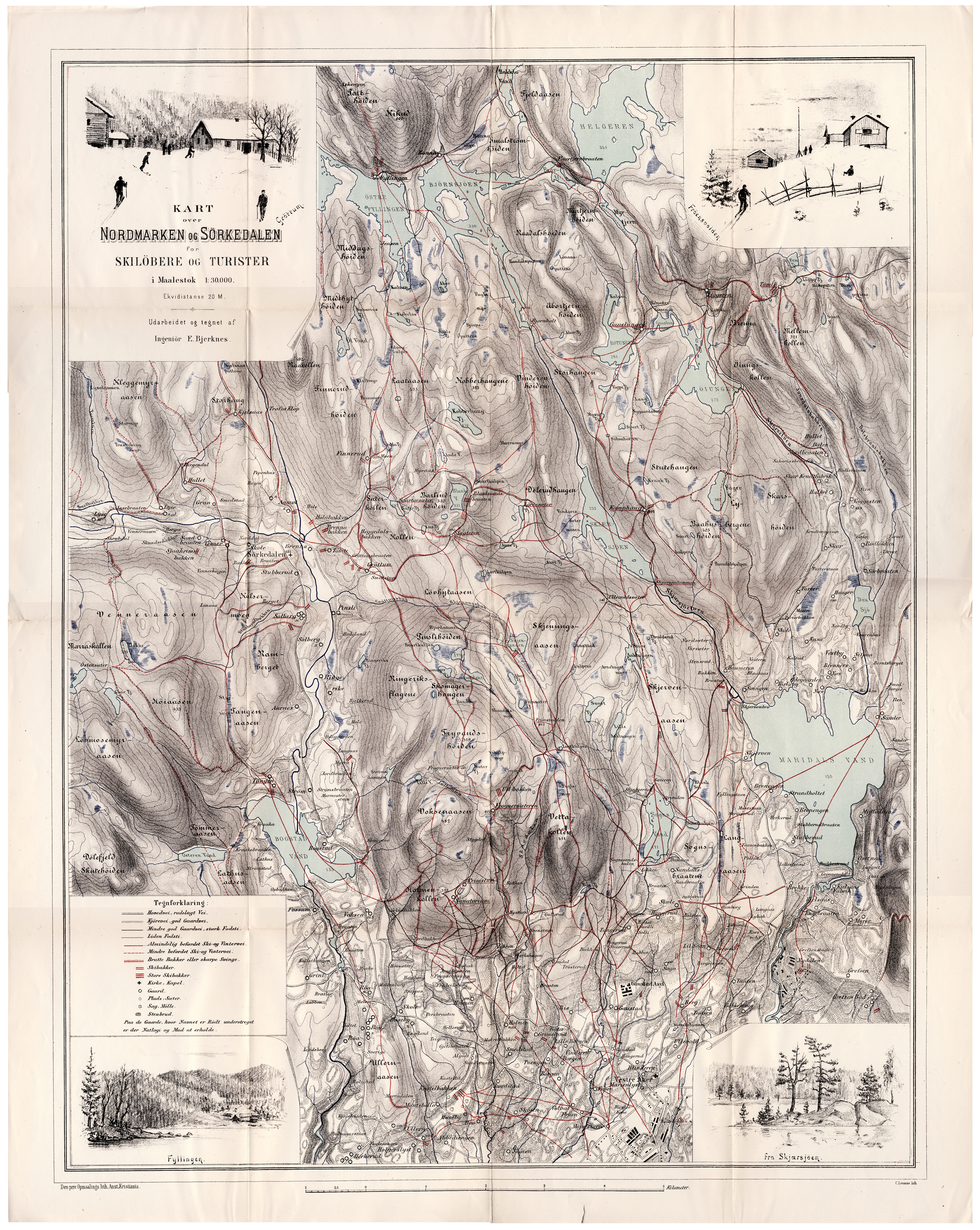
English: Map for skiers in Nordmarka, the forests north of Oslo. Author Ernst Wilhelm Bjerknes (1865-1955) was a Norwegian engineer and planner. He published this map in 1890, the world's first map for skiing. Norsk bokmål: Skikart over Nordmarka av ingeniør Ernst Wilhelm Bjerknes (1865-1955), utgitt i 1890 som verdens første skikart. |
| Date | |
| Source | Own work |
| Author | Roede |
Licensing
I, the copyright holder of this work, hereby publish it under the following license:
This file is licensed under the Creative Commons Attribution-Share Alike 4.0 International license.
- You are free:
- to share – to copy, distribute and transmit the work
- to remix – to adapt the work
- Under the following conditions:
- attribution – You must give appropriate credit, provide a link to the license, and indicate if changes were made. You may do so in any reasonable manner, but not in any way that suggests the licensor endorses you or your use.
- share alike – If you remix, transform, or build upon the material, you must distribute your contributions under the same or compatible license as the original.
File history
Click on a date/time to view the file as it appeared at that time.
| Date/Time | Thumbnail | Dimensions | User | Comment | |
|---|---|---|---|---|---|
| current | 17:17, 23 November 2015 | | 2,155 × 2,704 (5.9 MB) | commons>Roede | User created page with UploadWizard |
File usage
There are no pages that use this file.