File:Battle of Mount Sorrel - Battle Map - June 6 (restored1).jpg
Jump to navigation
Jump to search

Size of this preview: 373 × 600 pixels. Other resolutions: 149 × 240 pixels | 298 × 480 pixels | 477 × 768 pixels | 637 × 1,024 pixels | 1,741 × 2,800 pixels.
Original file (1,741 × 2,800 pixels, file size: 1.94 MB, MIME type: image/jpeg)
.jpg)
File history
Click on a date/time to view the file as it appeared at that time.
| Date/Time | Thumbnail | Dimensions | User | Comment | |
|---|---|---|---|---|---|
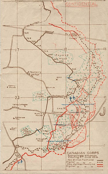
| current | 21:12, 19 December 2009 | | 1,741 × 2,800 (1.94 MB) | commons>Labattblueboy | {{Information |Description={{en|1=This map illustrates the British/Canadian positions (in brown) and the German lines (in red) on 4 June 1916, during the Battle of Mount Sorrel. The Canadians have been driven from several strong points, including Hooge no |
File usage
There are no pages that use this file.
.jpg)