File:Baltic Sea map Usedom location.png
Jump to navigation
Jump to search

Size of this preview: 734 × 600 pixels. Other resolutions: 294 × 240 pixels | 588 × 480 pixels | 940 × 768 pixels | 1,253 × 1,024 pixels | 1,476 × 1,206 pixels.
Original file (1,476 × 1,206 pixels, file size: 626 KB, MIME type: image/png)
File history
Click on a date/time to view the file as it appeared at that time.
| Date/Time | Thumbnail | Dimensions | User | Comment | |
|---|---|---|---|---|---|
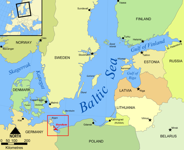
| current | 18:17, 5 October 2012 | | 1,476 × 1,206 (626 KB) | commons>Horst-schlaemma | {{Information |Description ={{en|1=Map of the Baltic Sea, German island of Usedom highlighted.}} {{de|1=Karte der Ostsee, die deutsche Insel Usedom ist hervorgehoben.}} |Source =Created by Wiki user NormanEinstein |Author =Cr... |
File usage
There are no pages that use this file.