File:Attack on Harper's Ferrypass5.jpg
Jump to navigation
Jump to search
Size of this preview: 526 × 600 pixels. Other resolutions: 210 × 240 pixels | 421 × 480 pixels | 673 × 768 pixels | 898 × 1,024 pixels | 1,688 × 1,925 pixels.
Original file (1,688 × 1,925 pixels, file size: 2.69 MB, MIME type: image/jpeg)
File history
Click on a date/time to view the file as it appeared at that time.
| Date/Time | Thumbnail | Dimensions | User | Comment | |
|---|---|---|---|---|---|
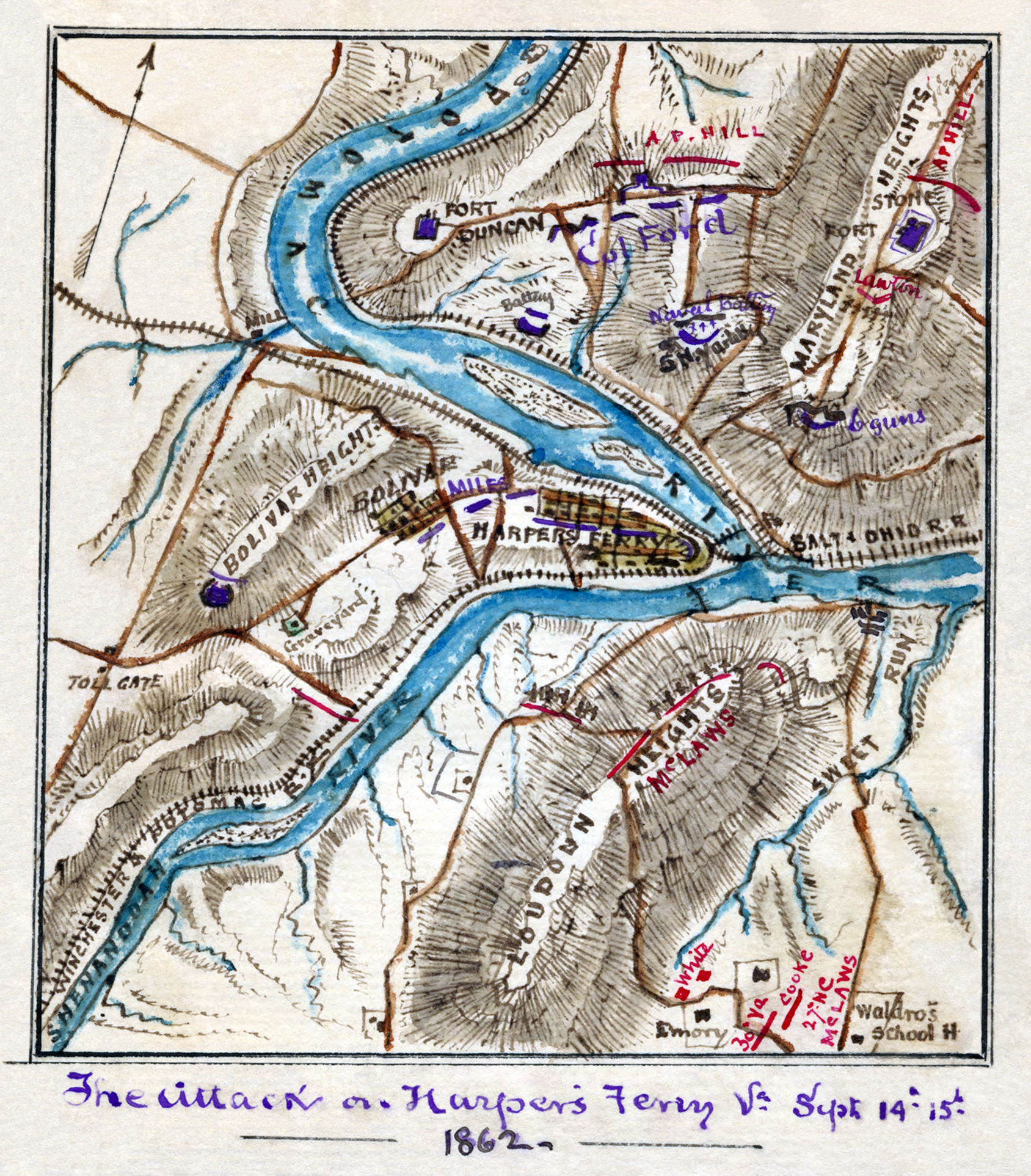
| current | 18:01, 22 July 2008 | | 1,688 × 1,925 (2.69 MB) | commons>Durova | {{Information |Description=Scan of a manuscript map by a Union Army mapmaker during the American Civil War. Shows the area surrounding Harper's Ferry, W. Va., at the intersection of the Potomac and Shenandoah Rivers as the Confederate forces under Jackso |
File usage
There are no pages that use this file.