File:Atlas des Sentiers et Chemins Vicinaux.jpg
Jump to navigation
Jump to search
No higher resolution available.
Atlas_des_Sentiers_et_Chemins_Vicinaux.jpg (422 × 600 pixels, file size: 75 KB, MIME type: image/jpeg)
| Description |
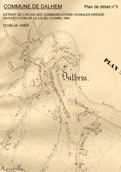
Français : Extrait du plan de l'Atlas des Sentiers et Chemins Vicinaux - Commune de Dalhem |
||
| Date | circa 1841 | ||
| Source | Extrait du plan de l'Atlas des Sentiers et Chemins Vicinaux - Commune de Dalhem | ||
| Author | Géomètre inconnu - Etat Belge | ||
| Permission (Reusing this file) |
|
File history
Click on a date/time to view the file as it appeared at that time.
| Date/Time | Thumbnail | Dimensions | User | Comment | |
|---|---|---|---|---|---|
| current | 20:11, 26 February 2009 | | 422 × 600 (75 KB) | commons>Janhsh | {{Information |Description={{fr|1=Extrait du plan de l'Atlas des Sentiers et Chemins Vicinaux - Commune de Dalhem }} |Source=Extrait du plan de l'Atlas des Sentiers et Chemins Vicinaux - Commune de Dalhem |Author=Géomètre inconnu - Etat Belge |Date=vers |
File usage
There are no pages that use this file.