File:Arrondissement Huy Belgium Map.png
Jump to navigation
Jump to search
No higher resolution available.
Arrondissement_Huy_Belgium_Map.png (290 × 220 pixels, file size: 7 KB, MIME type: image/png)
File history
Click on a date/time to view the file as it appeared at that time.
| Date/Time | Thumbnail | Dimensions | User | Comment | |
|---|---|---|---|---|---|
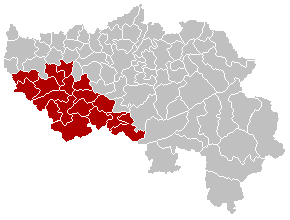
| current | 13:02, 24 September 2005 | | 290 × 220 (7 KB) | commons>Srtxg | EN; Map of Huy District in province of Liège, Belgium FR; Carte indiquant la localisation de l'arrondissement de Huy dans la Province de Liège. WA; Mape des comenes del province di Lidje, avou l' arondixhmint d' Hu e rodje. [[Category:Maps of provinc |
File usage
There are no pages that use this file.