File:Arnold Creek WV map.png
Jump to navigation
Jump to search

Size of this preview: 770 × 600 pixels. Other resolutions: 308 × 240 pixels | 616 × 480 pixels | 986 × 768 pixels | 1,280 × 997 pixels | 2,560 × 1,994 pixels | 2,891 × 2,252 pixels.
Original file (2,891 × 2,252 pixels, file size: 5.9 MB, MIME type: image/png)
File history
Click on a date/time to view the file as it appeared at that time.
| Date/Time | Thumbnail | Dimensions | User | Comment | |
|---|---|---|---|---|---|
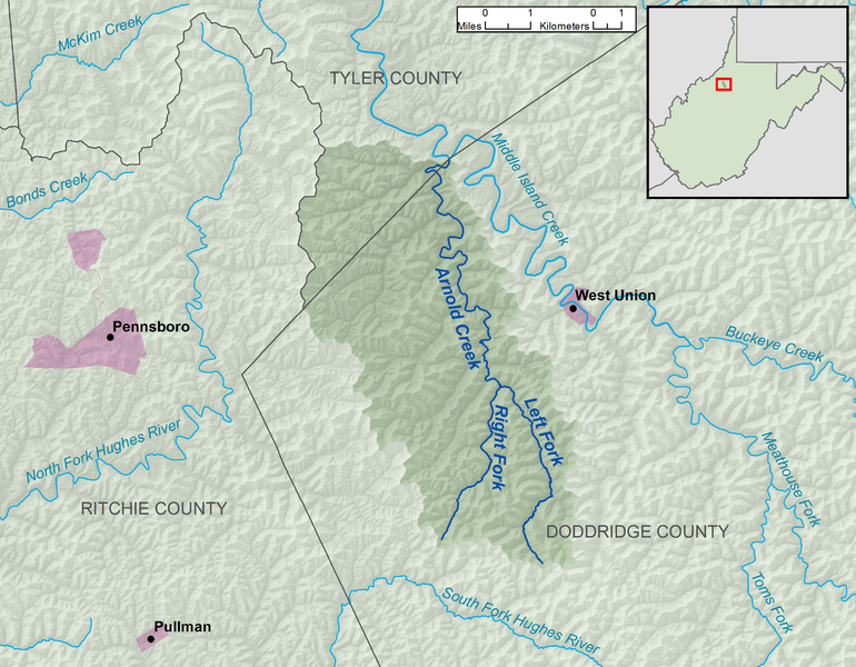
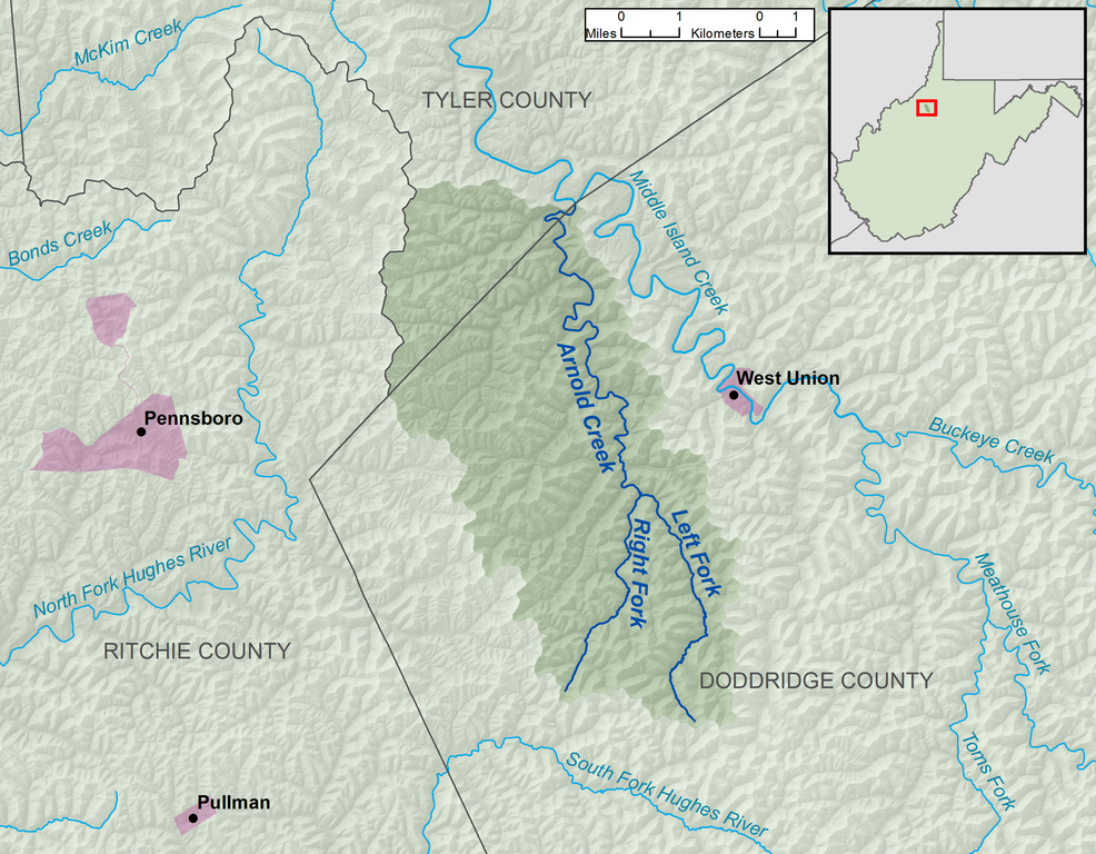
| current | 14:50, 13 December 2013 | | 2,891 × 2,252 (5.9 MB) | commons>TimK MSI | {{Information |Description ={{en|1=A map of Arnold Creek and its watershed (USGS HUC-12 code 050302010405), in Doddridge and Tyler Counties, West Virginia.}} |Source =O... |
File usage
There are no pages that use this file.