File:Arkansas river basin map.png
Jump to navigation
Jump to search

Size of this preview: 800 × 506 pixels. Other resolutions: 320 × 202 pixels | 640 × 405 pixels | 1,200 × 759 pixels.
Original file (1,200 × 759 pixels, file size: 1.46 MB, MIME type: image/png)
File history
Click on a date/time to view the file as it appeared at that time.
| Date/Time | Thumbnail | Dimensions | User | Comment | |
|---|---|---|---|---|---|
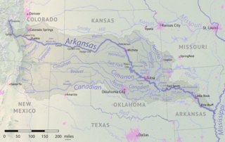
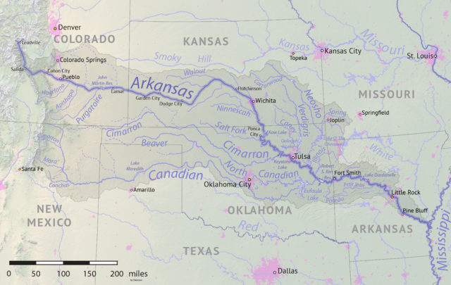
| current | 17:41, 18 May 2019 | | 1,200 × 759 (1.46 MB) | commons>Shannon1 | {{Information |description ={{en|1=Map of the Arkansas River drainage basin. Created using USGS National Map and NASA SRTM data.}} |date =2019-05-17 |source =Own work |author =Shannon1 }} Category:Arkansas River |
File usage
There are no pages that use this file.