File:Ardf map.png
Jump to navigation
Jump to search
No higher resolution available.
Ardf_map.png (600 × 550 pixels, file size: 430 KB, MIME type: image/png)
File history
Click on a date/time to view the file as it appeared at that time.
| Date/Time | Thumbnail | Dimensions | User | Comment | |
|---|---|---|---|---|---|
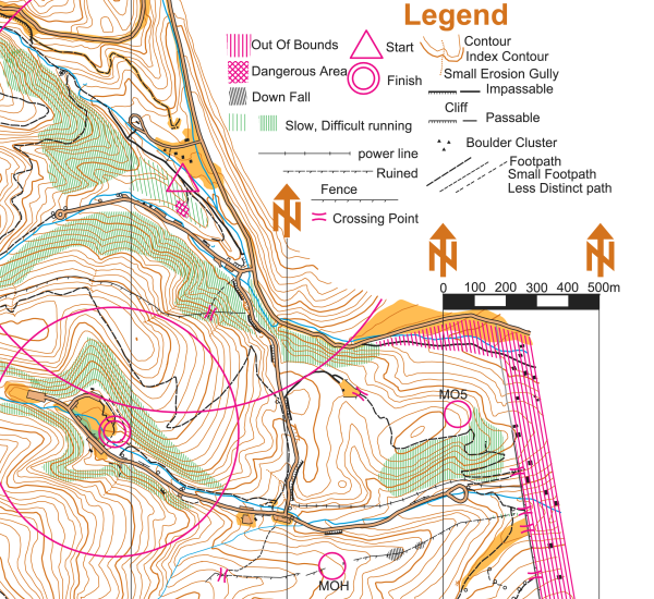
| current | 20:46, 12 March 2006 | | 600 × 550 (430 KB) | commons>Greudin | == Summary == On this portion of an ARDF map, the start location is indicated by a triangle and the finish location is indicated by two concentric circles. The locations of two of the five transmitters are indicated on |
File usage
There are no pages that use this file.