File:Apsley house on an 1869 Ordnance Survey Map.JPG
Jump to navigation
Jump to search
No higher resolution available.
Apsley_house_on_an_1869_Ordnance_Survey_Map.JPG (500 × 492 pixels, file size: 79 KB, MIME type: image/jpeg)
File history
Click on a date/time to view the file as it appeared at that time.
| Date/Time | Thumbnail | Dimensions | User | Comment | |
|---|---|---|---|---|---|
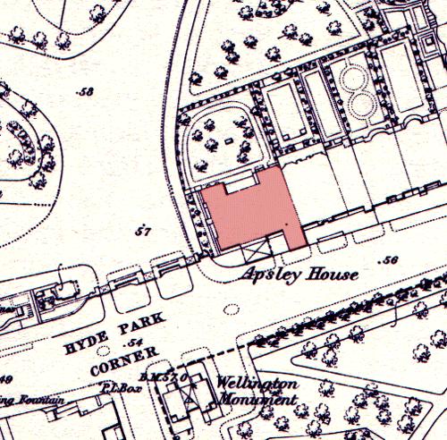
| current | 23:23, 5 October 2009 | | 500 × 492 (79 KB) | commons>File Upload Bot (Magnus Manske) | {{BotMoveToCommons|en.wikipedia|year={{subst:CURRENTYEAR}}|month={{subst:CURRENTMONTHNAME}}|day={{subst:CURRENTDAY}}}} {{Information |Description={{en|Apsley House on an 1869 en:Ordnance Survey map, showing its position at the end of a terrace. The |
File usage
There are no pages that use this file.