File:Ancient Western Mexico Archaeological Sites.svg
Jump to navigation
Jump to search

Size of this PNG preview of this SVG file: 349 × 334 pixels. Other resolutions: 251 × 240 pixels | 502 × 480 pixels | 803 × 768 pixels | 1,070 × 1,024 pixels | 2,140 × 2,048 pixels.
Original file (SVG file, nominally 349 × 334 pixels, file size: 227 KB)
Summary
| Description |
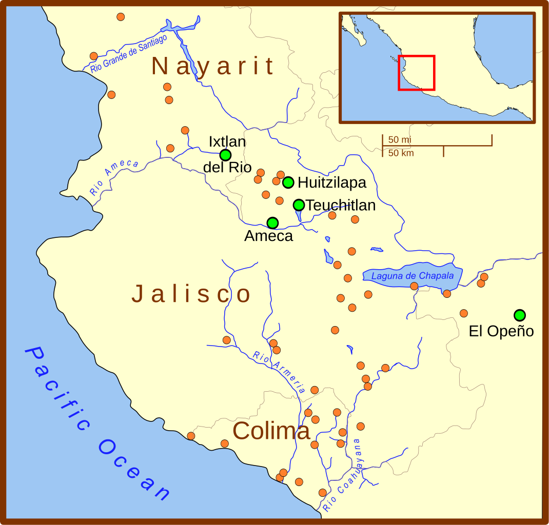
A map of Western Mexico highlighting archaeological sites associated with the w:en:Western Mexico shaft tomb tradition. The orange circles show archaeogical sites. The larger green circles highlight the most important sites. |
| Date | |
| Source | Own work |
| Author | Madman2001 |
| Other versions | Image:Teuchitlan tradition map.svg |
References
The location of the several dozen (orange) archaeological sites are from:
- Kan, Michael; Clement Meighan; H. B. Nicholson (1989) "The Pre-Columbian Art of West Mexico: Nayarit, Jalisco, Colima" in Sculpture of Ancient West Mexico, Nayarit, Jalisco, Colima, Los Angelese County Museum of Art, University of New Mexico Press, ISBN 0-8263-1175-x Invalid ISBN, p. 11.
The location of Huitzilapa, Teuchitlan, and other features (e.g. borders) were taken from various other maps.
Licensing
I, the copyright holder of this work, hereby publish it under the following license:
This file is licensed under the Creative Commons Attribution 3.0 Unported license.
- You are free:
- to share – to copy, distribute and transmit the work
- to remix – to adapt the work
- Under the following conditions:
- attribution – You must give appropriate credit, provide a link to the license, and indicate if changes were made. You may do so in any reasonable manner, but not in any way that suggests the licensor endorses you or your use.
File history
Click on a date/time to view the file as it appeared at that time.
| Date/Time | Thumbnail | Dimensions | User | Comment | |
|---|---|---|---|---|---|
| current | 23:02, 7 May 2008 | | 349 × 334 (227 KB) | commons>Madman2001 | {{Information |Description=A map of Western Mexico highlighting archaeological sites associated with the w:en:Western Mexico shaft tomb tradition. The orange circles show archaeogical sites. The larger green circles highlight the most important sites |
File usage
There are no pages that use this file.