File:Americas satellite map.jpg
Jump to navigation
Jump to search

Size of this preview: 475 × 599 pixels. Other resolutions: 190 × 240 pixels | 381 × 480 pixels | 609 × 768 pixels | 812 × 1,024 pixels | 2,300 × 2,900 pixels.
Original file (2,300 × 2,900 pixels, file size: 1.87 MB, MIME type: image/jpeg)
File history
Click on a date/time to view the file as it appeared at that time.
| Date/Time | Thumbnail | Dimensions | User | Comment | |
|---|---|---|---|---|---|
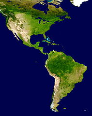
| current | 17:23, 28 June 2008 | | 2,300 × 2,900 (1.87 MB) | commons>WolfmanSF | {{Information |Description=This spectacular “blue marble” image is the most detailed true-color image of the entire Earth to date. Using a collection of satellite-based observations, scientists and visualizers stitched together months of observations |
File usage
There are no pages that use this file.