File:Airports New York City Map Julius Schorzman.png
Jump to navigation
Jump to search

Size of this preview: 616 × 600 pixels. Other resolutions: 247 × 240 pixels | 493 × 480 pixels | 789 × 768 pixels | 1,052 × 1,024 pixels | 2,104 × 2,048 pixels | 2,652 × 2,582 pixels.
Original file (2,652 × 2,582 pixels, file size: 6.2 MB, MIME type: image/png)
File history
Click on a date/time to view the file as it appeared at that time.
| Date/Time | Thumbnail | Dimensions | User | Comment | |
|---|---|---|---|---|---|
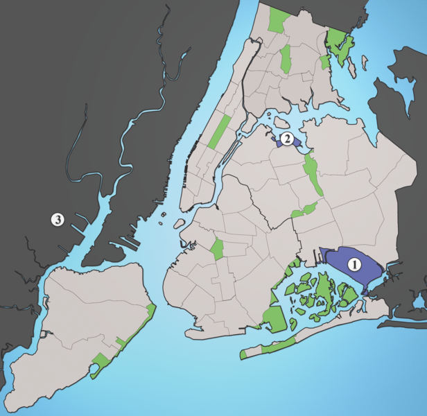
| current | 02:26, 19 August 2005 | | 2,652 × 2,582 (6.2 MB) | commons>Quasipalm | A map showing the major airports serving New York City. # JFK # LGA # EWR Source: I created this image using various maps and images. {{cc-by-sa-2.5}} Category:Maps of New York CityCategory:Images created by user Julius Schorzman\ |
File usage
There are no pages that use this file.