File:Agriates.png
Jump to navigation
Jump to search

Size of this preview: 800 × 528 pixels. Other resolutions: 320 × 211 pixels | 640 × 423 pixels | 1,024 × 676 pixels | 1,280 × 845 pixels | 1,655 × 1,093 pixels.
Original file (1,655 × 1,093 pixels, file size: 2.63 MB, MIME type: image/png)
File history
Click on a date/time to view the file as it appeared at that time.
| Date/Time | Thumbnail | Dimensions | User | Comment | |
|---|---|---|---|---|---|
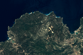
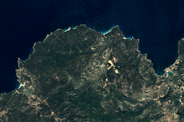
| current | 13:54, 25 September 2011 | | 1,655 × 1,093 (2.63 MB) | commons>Telperion | {{Information |Description ={{en|1=Agriates region, located on the north of Corsica (France). This satellite view was acquired by Landsat 7. The city of Saint-Florent i |
File usage
There are no pages that use this file.