File:Afghanistan physical en.png
Jump to navigation
Jump to search

Size of this preview: 768 × 600 pixels. Other resolutions: 307 × 240 pixels | 615 × 480 pixels | 983 × 768 pixels | 1,280 × 1,000 pixels | 2,079 × 1,624 pixels.
Original file (2,079 × 1,624 pixels, file size: 4.46 MB, MIME type: image/png)
File history
Click on a date/time to view the file as it appeared at that time.
| Date/Time | Thumbnail | Dimensions | User | Comment | |
|---|---|---|---|---|---|
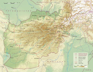
| current | 12:43, 10 September 2010 | | 2,079 × 1,624 (4.46 MB) | commons>Sommerkom | == Beschreibung, Quelle == {{Information |Beschreibung = Physical map of Afghanistan, administrative division into 34 provinces following the administrative reform from 2005. |Quelle = Selfmade, topographic data: [http://www2.jpl.nasa.gov/srtm/index.html |
File usage
There are no pages that use this file.