File:Aerial VolusiaSpeedwayPark01.jpg
Jump to navigation
Jump to search

Size of this preview: 600 × 600 pixels. Other resolutions: 240 × 240 pixels | 480 × 480 pixels.
Original file (800 × 800 pixels, file size: 115 KB, MIME type: image/jpeg)
Summary
| Description |
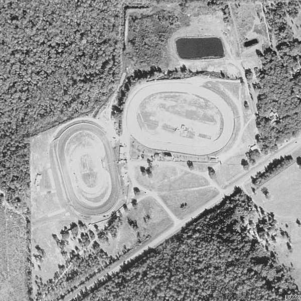
English: Aerial view of Volusia Speedway Park, in Barberville, Florida, United States |
| Date | |
| Source | USGS The National Map, via MSR Maps (formerly TerraServer-USA) |
| Author | United States Geological Survey (USGS) |
| Permission (Reusing this file) |
Public domain |
Licensing
This image is in the public domain in the United States because it only contains materials that originally came from the United States Geological Survey, an agency of the United States Department of the Interior. For more information, see the official USGS copyright policy.
|
File history
Click on a date/time to view the file as it appeared at that time.
| Date/Time | Thumbnail | Dimensions | User | Comment | |
|---|---|---|---|---|---|
| current | 07:11, 11 January 2009 | | 800 × 800 (115 KB) | commons>Gamweb | {{Information |Description={{en|1=Aerial view of Volusia Speedway Park, Barberville, Florida. US Geological Survey, Terraservice Web Map Server, 07 January 1999.}} |Source=http://terraserver-usa.com/map.aspx?t=1&s=10&lon=-81.345&lat=29.215&w=800&h=800 |Au |
File usage
There are no pages that use this file.