File:Acushnet River (Massachusetts) map.jpg
Jump to navigation
Jump to search
Size of this preview: 364 × 600 pixels. Other resolutions: 146 × 240 pixels | 291 × 480 pixels | 466 × 768 pixels | 622 × 1,024 pixels | 1,700 × 2,800 pixels.
Original file (1,700 × 2,800 pixels, file size: 1.55 MB, MIME type: image/jpeg)
_map.jpg)
File history
Click on a date/time to view the file as it appeared at that time.
| Date/Time | Thumbnail | Dimensions | User | Comment | |
|---|---|---|---|---|---|
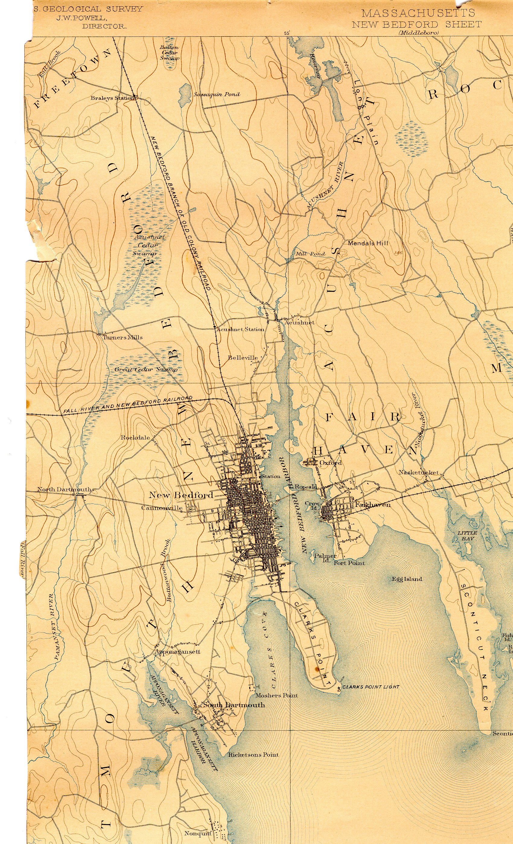
| current | 10:05, 13 December 2006 | | 1,700 × 2,800 (1.55 MB) | commons>Daderot | {{Information |Description=Map of Acushnet River and environs near Fairhaven, Massachusetts. |Source=USGS 15 Minute Series, New Bedford, MA Quadrangle, 1893. Northwest corner. |Date=1893. |Author=United States Geological Survey, US Department of the Inter |
File usage
There are no pages that use this file.
_map.jpg)