File:Acheshbok, Южные отроги горы Ачешбок, драматичные погодные условия раннего лета, Западный Кавказ.jpg
Original file (4,912 × 3,264 pixels, file size: 8.82 MB, MIME type: image/jpeg)
This file is from a shared repository and may be used by other projects. The description on its file description page there is shown below.
Summary
DescriptionAcheshbok, Южные отроги горы Ачешбок, драматичные погодные условия раннего лета, Западный Кавказ.jpg |
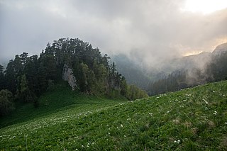
Русский: Большой Тхач: Майкопский район, Адыгея
English: Bolshoy Thach: Maykop district, Adygea
|
|||
Date | Taken on 5 June 2015, 19:27:24 | |||
Source | Own work | |||
Author | Vyacheslav Argenberg |
Camera location | 43° 58′ 08.31″ N, 40° 28′ 23.39″ E | View this and other nearby images on: OpenStreetMap | 43.968975; 40.473163 |
---|
This image was taken by Vyacheslav Argenberg
If you have any questions, comments or queries, please contact me. |
Licensing
- You are free:
- to share – to copy, distribute and transmit the work
- to remix – to adapt the work
- Under the following conditions:
- attribution – You must give appropriate credit, provide a link to the license, and indicate if changes were made. You may do so in any reasonable manner, but not in any way that suggests the licensor endorses you or your use.
This image was uploaded as part of Wiki Loves Earth 2019.
aragonés | العربية | asturianu | azərbaycanca | беларуская (тарашкевіца) | български | বাংলা | brezhoneg | català | čeština | Cymraeg | Deutsch | Ελληνικά | English | español | eesti | euskara | فارسی | français | galego | עברית | hrvatski | հայերեն | Bahasa Indonesia | italiano | 日本語 | ქართული | 한국어 | latviešu | македонски | മലയാളം | मराठी | Bahasa Melayu | norsk bokmål | नेपाली | Nederlands | norsk | polski | português | português do Brasil | русский | sicilianu | shqip | slovenščina | српски / srpski | svenska | ไทย | Türkçe | українська | اردو | 中文 | 中文(台灣) | +/− |
Items portrayed in this file
depicts
some value
43°58'8.310"N, 40°28'23.387"E
5 June 2015
0.00625 second
17 millimetre
200
image/jpeg
a02ab254154157a9ea7c55d983bea454522e2c83
9,249,757 byte
3,264 pixel
4,912 pixel
File history
Click on a date/time to view the file as it appeared at that time.
Date/Time | Thumbnail | Dimensions | User | Comment | |
---|---|---|---|---|---|
current | 12:39, 16 May 2019 | 4,912 × 3,264 (8.82 MB) | commons>Argenberg | User created page with UploadWizard |
File usage
There are no pages that use this file.
Metadata
This file contains additional information, probably added from the digital camera or scanner used to create or digitize it.
If the file has been modified from its original state, some details may not fully reflect the modified file.
Image title |
|
---|---|
Camera manufacturer | SONY |
Camera model | SLT-A55V |
Exposure time | 1/160 sec (0.00625) |
F Number | f/4 |
ISO speed rating | 200 |
Date and time of data generation | 19:27, 5 June 2015 |
Lens focal length | 17 mm |
Latitude | 43° 58′ 8.31″ N |
Longitude | 40° 28′ 23.39″ E |
Altitude | 2,114.4 meters above sea level |
Orientation | Normal |
Horizontal resolution | 300 dpi |
Vertical resolution | 300 dpi |
Software used | Adobe Photoshop CS4 Windows |
File change date and time | 02:16, 16 May 2019 |
Exposure Program | Aperture priority |
Exif version | 2.3 |
Date and time of digitizing | 19:27, 5 June 2015 |
APEX shutter speed | 7.321928 |
APEX aperture | 4 |
APEX brightness | 6.12 |
APEX exposure bias | 0 |
Maximum land aperture | 3 APEX (f/2.83) |
Metering mode | Pattern |
Light source | Unknown |
Flash | Flash did not fire, compulsory flash suppression |
Color space | sRGB |
Focal plane X resolution | 209.91452026367 |
Focal plane Y resolution | 209.91452026367 |
Focal plane resolution unit | 4 |
File source | Digital still camera |
Scene type | A directly photographed image |
Custom image processing | Normal process |
Exposure mode | Auto exposure |
White balance | Auto white balance |
Focal length in 35 mm film | 25 mm |
Scene capture type | Standard |
Contrast | Normal |
Saturation | Normal |
Sharpness | Normal |
GPS time (atomic clock) | 16:09 |
Receiver status | Measurement interoperability |
Measurement mode | 3-dimensional measurement |
Speed unit | Kilometers per hour |
Speed of GPS receiver | 0.5 |
Reference for direction of movement | True direction |
Direction of movement | 175.39 |
Geodetic survey data used | WGS-84 |
GPS date | 5 June 2015 |
GPS differential correction | 0 |
GPS tag version | 0.0.3.2 |
Lens used | 17-50mm F2.8 |
Image width | 4,912 px |
Image height | 3,264 px |
Date metadata was last modified | 05:16, 16 May 2019 |
Unique ID of original document | 9F8228316923F1295F19A87AE461F362 |
IIM version | 4 |